Pontos de mergulho, épocas e vida marinha — pesquisados, mapeados, planeados.
Menu
Destinos Pontos de Mergulho Vida Marinha Naufrágios Notícias
Planejar uma viagem Planejador de viagem Quando mergulhar Calculadora de custos Comparações Calendário de vida marinha Temperatura da água Liveaboards Operadores & resorts Parques marinhos Câmaras hiperbáricas Mapa mundial
Regiões Austrália, Nova Zelândia e Ásia OrientalCaribe e Atlântico OcidentalEuropa, Atlântico & MediterrâneoOceano Índico e África OrientalIlhas do Pacífico & MicronésiaMar Vermelho & Médio OrienteSudeste Asiático e Triângulo de CoralAs Américas e o Pacífico Oriental Países
Aprender e Ferramentas Todos os guias Certificações Guias de equipamento Vídeos Consulte os Dados Agentes de IA API
Sobre Sobre nós Metodologia Aviso legal Contato
A sua vista
★ Guardado

Os seus destinos, sítios de mergulho e espécies favoritos — guardados neste browser.

API GATEWAY

Acesso JSON gratuito e só de leitura aos dados em cache do atlas.

Modo escuro

🧭 Vista Guiada
Novo no mergulho — profundidades, correntes, níveis de certificação? Explicamos cada termo enquanto navega, em linguagem simples. Os mesmos dados, com a ajuda integrada.

⚡ Vista de Especialista
Já sabe a diferença entre uma parede e um drift dive. Apenas os dados — claros, rápidos e compactos. Esta é a vista predefinida.

Idioma da interface
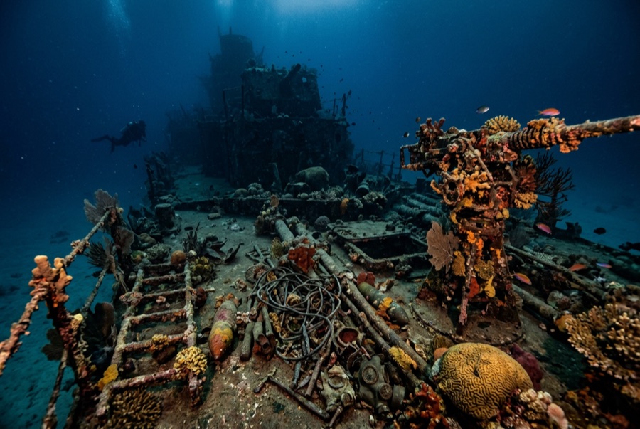
Million Dollar Point — illustrative image

Million Dollar Point

Second World War military equipment dump (debris field, not a vessel) Afundado 1945 1–40 m Espiritu Santo
Ilustração gerada por IA
Houve vidas perdidas aquiNone. Os operadores locais pedem que o naufrágio seja mergulhado com o respeito correspondente.
Documentado
Profundidade até o convés
1 m / 3 ft
Profundidade máxima
40 m / 131 ft
Construído / afundado
? / 1945
Orientação
A Jumbled Slope Of Machinery From The Shoreline Into Deep Water
Nível
Beginner
Melhores meses
Apr–Oct

A história

When the Pacific war ended, Espiritu Santo held one of the largest American bases on earth, and shipping mountains of used equipment home made no economic sense. The story told on Santo — supported by what lies on the seabed — is that the US offered the lot to the Anglo-French authorities at a token price, the local administration stalled in the expectation of getting it free, and the Americans answered by building a ramp and driving the inventory into the sea: bulldozers, six-wheeled trucks, jeeps, cranes, forklifts, sheet steel, engines, and crate upon crate of stores, with Coca-Cola bottles beyond counting. The name records the estimated value of what went over. Today the point is a shore dive down a slope of interlocked machinery, axles and tracks fused by coral into a single sardonic monument to logistics. Two later shipwrecks lie among the debris, casualties of salvage attempts on the very metal being thrown away.

Como afundou: US forces deliberately dumped surplus equipment into the sea at the end of the war after disposal negotiations failed.

A mergulhar nela hoje

Condição: A rust garden in slow collapse; recognizable machines emerge and disappear as the pile settles and storms rearrange the shallows.

Penetração: None. There is no hull to enter — only unstable stacked machinery, and wriggling into gaps between forty-ton machines is how divers get hurt.

Certificação recomendada: Open Water

Corrente: Mild · Visibilidade: 5–15 m

Vida marinha: Corals colonize axles and cab frames, octopus den in engine blocks, lionfish and sweepers fill the truck beds, and reef fish swarm the shallows where snorkelers drift.

Perigos: Sharp, unstable metal throughout; surge in the shallows; broken glass near the old bottle dumps.

Proteção & legislação

Protected alongside the Coolidge under Vanuatu's wreck-site rules; local fees apply at the shore entry.

Bottles and brass have walked away for decades — the site is protected now, so leave every piece in the pile.

Assista

Dos canais oficiais

Todos os vídeos →

Os vídeos são links incorporados dos próprios canais dos criadores — não hospedamos nada e creditamos tudo.

Fontes: Vanuatu Tourism ↗Wikipedia ↗ · Factos verificados em relação às fontes acima; os campos sem suporte estão assinalados como não verificado ainda.

Austrália, Nova Zelândia e Ásia Oriental

Cairns & the Ribbon ReefsNingaloo ReefCoral Sea & Osprey ReefOkinawa & the Kerama IslandsPoor Knights IslandsTownsville & the YongalaGreen IslandIzu Peninsula

Caribe e Atlântico Ocidental

BonaireCozumelRiviera Maya & the CenotesBelize Barrier ReefGrand CaymanIsla Mujeres & CancúnRoatánTiger Beach & Grand Bahama

Europa, Atlântico & Mediterrâneo

Malta & GozoSilfra & IcelandThe AzoresCanary IslandsLarnaca & the ZenobiaScapa FlowArctic NorwayMadeira

Oceano Índico e África Oriental

North & South Malé AtollsAri AtollBaa Atoll & Hanifaru BayAliwal Shoal & UmkomaasMafia IslandMauritiusSeychellesSodwana Bay

Ilhas do Pacífico & Micronésia

PalauChuuk (Truk) LagoonFakaravaKona, HawaiʻiRangiroaTaveuni & Rainbow ReefBeqa Lagoon & Pacific HarbourEspiritu Santo

Mar Vermelho & Médio Oriente

Sharm El Sheikh & Ras MohammedBrothers, Daedalus & St John'sDahabHurghada & El GounaMarsa Alam & the Deep SouthAqabaDaymaniyat IslandsMusandam Peninsula

Sudeste Asiático e Triângulo de Coral

Bali & Nusa PenidaKomodoRaja AmpatSipadan & MabulAnilaoCoronKoh TaoLembeh Strait

As Américas e o Pacífico Oriental

Galápagos IslandsCocos IslandFlorida KeysSea of Cortez & Cabo PulmoSocorro & the RevillagigedosBritish ColumbiaCalifornia Channel IslandsCosta Rica Pacific Coast