Siti di immersione, stagioni e fauna marina — ricercati, mappati, pianificati.
Menu
Destinazioni Siti di immersione Vita marina Relitti Notizie
Pianifica un viaggio Pianificatore di viaggi Quando immergersi Calcolatore dei costi Confronti Calendario della fauna marina Temperatura dell'acqua Liveaboard Operatori & resort Parchi marini Camere iperbariche Mappa del mondo
Regioni Australia, Nuova Zelanda e Asia OrientaleCaraibi e Atlantico occidentaleEuropa, Atlantico e MediterraneoOceano Indiano e Africa OrientaleIsole del Pacifico & MicronesiaMar Rosso & Medio OrienteAsia meridionale e Triangolo dei CoralliLe Americhe e il Pacifico orientale Paesi
Impara e strumenti Tutte le guide Brevetti Guide all'attrezzatura Video Interroga i dati AI Agent API
Informazioni Chi siamo Metodologia Disclaimer Contatti
La tua vista
★ Salvato

Le tue destinazioni, siti e specie preferiti — salvati in questo browser.

API GATEWAY

Accesso JSON gratuito in sola lettura ai dati in cache dell'atlante.

Modalità scura

🧭 Visualizzazione Guidata
Sei nuovo alle immersioni — profondità, correnti, livelli di brevetto? Spieghiamo ogni termine mentre navighi, in modo semplice e chiaro. Gli stessi dati, con il supporto integrato.

⚡ Visualizzazione Esperta
Conosci già la differenza tra una parete e una drift dive. Solo i dati — chiari, rapidi e compatti. Questa è la visualizzazione predefinita.

Lingua dell'interfaccia
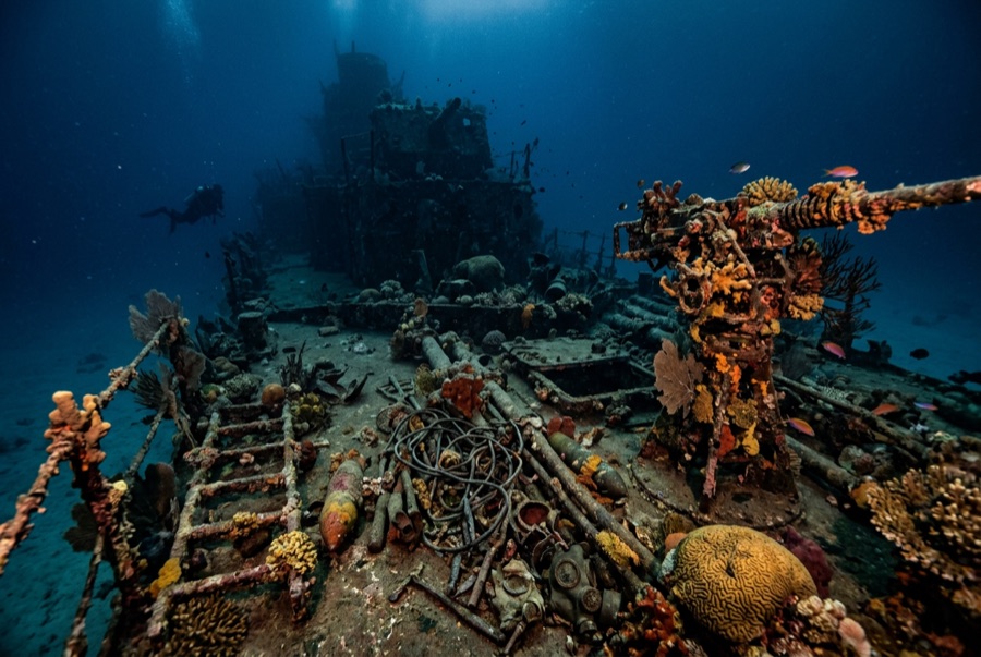
Okikawa Maru — illustrative image

Okikawa Maru

Japanese civilian fleet tanker Affondata 1944 10–26 m Coron
Illustrazione generata dall'AI
Documentato
Profondità al ponte
10 m / 33 ft
Profondità massima
26 m / 85 ft
Costruito / affondato
1938 / 1944
Lunghezza
168 m
Orientamento
Upright
Livello
Intermediate
Mesi migliori
Dec–May

La storia

For decades dive guides called this ship the Taiei Maru, and the wrong name still surfaces in briefings — wreck identification in Coron was untangled slowly, from rivet counts and archival manifests. She was the Okikawa Maru, a big civilian tanker of the late 1930s pressed into naval service to move the fuel that Japan's war ran on. Anchored off Concepcion when the September 1944 carrier raid swept Coron Bay, she was hit and left burning, and air attacks in early October put her on the bottom for good. She settled upright in comfortable depths, which is why she has become the most dived wreck in the bay: her main deck lies shallow enough for long, unhurried tours, and her pump rooms and long tunnel-like passages give wreck students their first taste of overhead. The bow section, wrenched by the attacks, drops away in a tangle that rewards a slow look. Corals have made a garden of her catwalks.

Come è affondata: Damaged in the 24 September 1944 Coron raid and finished by follow-up air attacks in October 1944.

Immersioni su di essa oggi

Condizione: Upright and diveable end to end, though the bow area is heavily broken and the hull is softening after eighty years.

Penetrazione: Full With Training. The engine room and fore-and-aft passageways are Coron's classic guided penetrations; training and a guide are expected, and silt punishes poor trim. Entrare in qualsiasi ambiente overhead richiede una formazione specifica — come minimo una certificazione wreck, e una formazione tecnica wreck per la penetrazione completa.

Certificazione consigliata: Advanced Open Water; wreck training for interiors

Corrente: Mild · Visibilità: 5–15 m

Vita marina: Hard and soft corals across the deck, sweetlips and batfish in the shade of the superstructure, banded sea kraits hunting the plating, turtles overhead.

Pericoli: Visibility can fall to a few meters; interior silt; occasional current over the bow.

Tutela & normativa

Protected wartime wreck; Coron local dive fees apply.

Portholes and fittings stay on the ship — removal is prohibited.

Guarda

Dai canali ufficiali

Tutti i video →

I video sono link incorporati ai canali dei rispettivi autori — non ospitiamo nulla e diamo sempre credito a tutti.

Fonti: CombinedFleet.com ↗PacificWrecks.com ↗ · Dati verificati rispetto alle fonti indicate; i campi privi di riscontro sono contrassegnati come non ancora verificati.

Australia, Nuova Zelanda e Asia Orientale

Cairns & the Ribbon ReefsNingaloo ReefCoral Sea & Osprey ReefOkinawa & the Kerama IslandsPoor Knights IslandsTownsville & the YongalaGreen IslandIzu Peninsula

Caraibi e Atlantico occidentale

BonaireCozumelRiviera Maya & the CenotesBelize Barrier ReefGrand CaymanIsla Mujeres & CancúnRoatánTiger Beach & Grand Bahama

Europa, Atlantico e Mediterraneo

Malta & GozoSilfra & IcelandThe AzoresCanary IslandsLarnaca & the ZenobiaScapa FlowArctic NorwayMadeira

Oceano Indiano e Africa Orientale

North & South Malé AtollsAri AtollBaa Atoll & Hanifaru BayAliwal Shoal & UmkomaasMafia IslandMauritiusSeychellesSodwana Bay

Isole del Pacifico & Micronesia

PalauChuuk (Truk) LagoonFakaravaKona, HawaiʻiRangiroaTaveuni & Rainbow ReefBeqa Lagoon & Pacific HarbourEspiritu Santo

Mar Rosso & Medio Oriente

Sharm El Sheikh & Ras MohammedBrothers, Daedalus & St John'sDahabHurghada & El GounaMarsa Alam & the Deep SouthAqabaDaymaniyat IslandsMusandam Peninsula

Asia meridionale e Triangolo dei Coralli

Bali & Nusa PenidaKomodoRaja AmpatSipadan & MabulAnilaoCoronKoh TaoLembeh Strait

Le Americhe e il Pacifico orientale

Galápagos IslandsCocos IslandFlorida KeysSea of Cortez & Cabo PulmoSocorro & the RevillagigedosBritish ColumbiaCalifornia Channel IslandsCosta Rica Pacific Coast