Pluragrotta–Steinugleflåget system
About 2,600 m according to the Norwegian cave divers' association page current in 2026 (survey date not given). NRK reported in 2016 that the cave had been mapped to more than 2,000 m along an underground river stretch of 3.8 km; the regional tourism listing gives about 3 km. NGDF describes the deep run as descending to about 130 m. NRK (2016) reported that the first known deep dive, in 1980, reached about 135 m.
Norway's best-known diveable cave: a cold river cave in Plurdalen near Mo i Rana, mapped to roughly 2.6 km with a deep section reaching about 130 m that links the Plura resurgence to the dry cave Steinugleflåget.
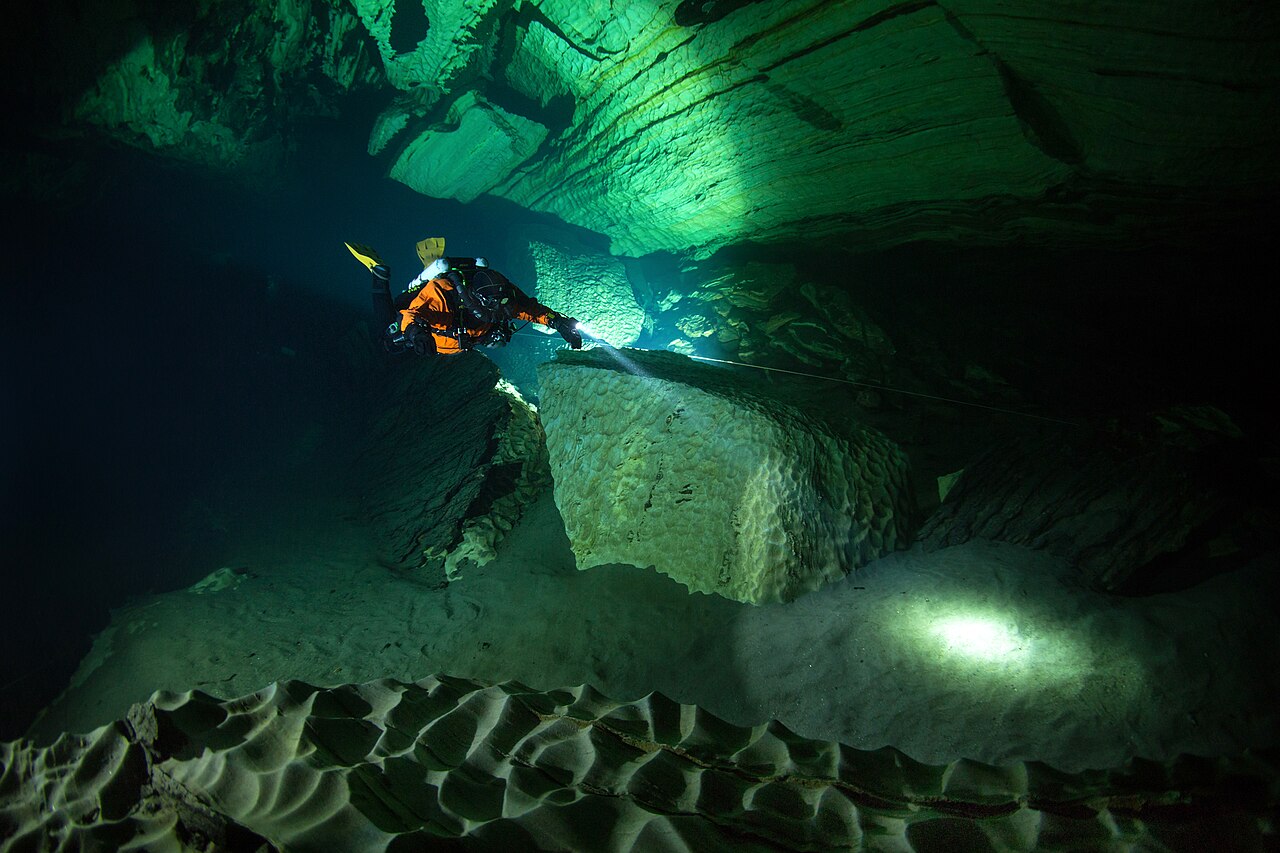
Pluragrotta is a flooded river cave at the farm Jordbru in Plurdalen, near Mo i Rana in Nordland. The Plura river sinks into a collapse called Trollkjærka and reappears about 200 m from the farm in a pool that serves as the main diving entrance. The Norwegian cave divers' association (NGDF) describes it as Norway's largest and best-known diveable cave.
From the resurgence pool a guideline runs through the cavern zone into the cave. An air-filled chamber lies roughly 450 m in, and most of the route to it stays within about 30 m depth. Beyond the chamber a deep section descends to around 130 m before rising again towards Steinugleflåget, a dry cave higher on the hillside that gives a second, much harder entrance to the same system.
The water is near freezing for much of the year and usually very clear, except during spring snowmelt. Divers experience long, cold, technical dives; the deep connection is an expedition-level undertaking. On 6 February 2014 two Finnish divers died in the deep section, and police imposed an access ban on the caves that was lifted on 31 March 2014.
A dive centre beside the entrance sells guided dive packages, accommodation, gas and training, and NGDF organises community events and maintains guidelines in Norwegian caves.
Acqua, corrente e allagamenti
An underground stretch of the Plura river: water sinks at the Trollkjærka collapse and resurges in the pool used as the diving entrance. Visibility drops sharply in May during snowmelt, according to the local dive centre.
Condizioni
The local dive centre gives about 1.5 °C in winter and up to 7 °C in late summer and autumn; NGDF gives 3-6 °C. Visibility is typically around 35 m, can reach about 100 m in March-April and falls to 2-3 m in May snowmelt (dive centre figures).
Intervalli tipici da fonti pubblicate, non condizioni attuali.
Storia del rilievo e dell'esplorazione
| 1980 | First known deep dive in the cave, by Svein Grundstrøm and Bjørn Fagertun. [3] |
| 2010-08 | Finnish divers dive the sumps of Steinugleflåget after carrying rebreathers down the dry cave. [5] |
| 2014-02-06 | Two Finnish divers die in the deep section; three others are treated for decompression sickness. [3] |
| 2014-03-31 | The Helgeland police chief lifts the access ban placed on the Plura caves after the accident. [4] |
Accessi e siti di immersione
Two entrances are documented: the Plura resurgence pool near the farm Jordbru (the normal diving entrance, beside the dive centre) and Steinugleflåget, a dry cave whose sumps are reached after a steep descent of about 100 m. Only the resurgence pool is used for normal diving.
Per orientamento, non per navigazione. I punti vuoti sono approssimativi.
Ogni informazione in questa pagina, con la relativa fonte (11)
| Informazione | Stato | Fonte |
|---|---|---|
| Pluragrotta is about 2,600 m long.NGDF gives about 2,600 m; NRK (2016) says mapped to more than 2,000 m; Visit Helgeland says about 3 km. No dated survey publication was found. | Le fonti non concordano | [1] |
| The deep run beyond the air chamber descends to about 130 m.NGDF: about 130 m. NRK 2016: first known dive in 1980 reached about 135 m and the 2014 accident happened at about 130 m. | Le fonti non concordano | [1] [3] |
| Water is about 1.5 °C in winter and up to 7 °C in late summer and autumn.Dive centre figures; NGDF gives 3-6 °C. | Segnalato | [2] [1] |
| Visibility is around 35 m most of the year, about 100 m in March-April and 2-3 m in May snowmelt.Provider claim. | Segnalato | [2] |
| The Helgeland police chief lifted the access ban (ferdselsforbud) on the Plura caves on Monday 31 March 2014.Newspaper report quoting the police district's press release. | Segnalato | [4] |
| Police had imposed an access ban on the cave after the February 2014 accident, which the Finnish recovery team broke in March 2014. | Segnalato | [3] |
| Divers without cave training may dive the pool or the cavern zone, which has its own line, together with an experienced cave diver.Guidance from the national cave divers' association, not a legal rule. | Verificato | [1] |
| The first known deep dive was made in 1980 by Svein Grundstrøm and Bjørn Fagertun. | Segnalato | [3] |
| On 6 February 2014 two Finnish divers died and three were treated in a pressure chamber; on 26 March 2014 a private team of 17 Finnish divers recovered the bodies. | Segnalato | [3] |
| Steinugleflåget's sumps lie about 100 m below the dry-cave entrance; Finnish divers recorded +6 °C water and areas down to about 70 m there in August 2010.Trip report by the divers. | Segnalato | [5] |
| The Plura Valley dive centre at the cave entrance is mapped at about 66.282 N, 14.732 E.Coordinates from the regional tourism board listing; given at area precision. | Verificato | [6] |
Verificato: dichiarato da una fonte ufficiale o primaria che abbiamo consultato. Segnalato: da una fonte secondaria soltanto. Le fonti sono in contrasto: la nota riporta entrambe le versioni. Potrebbe essere non aggiornato: la fonte più recente che abbiamo trovato è datata.
Scritto con parole nostre dalle fonti indicate sopra. Segnala una correzione