Banda Sea & Ambon
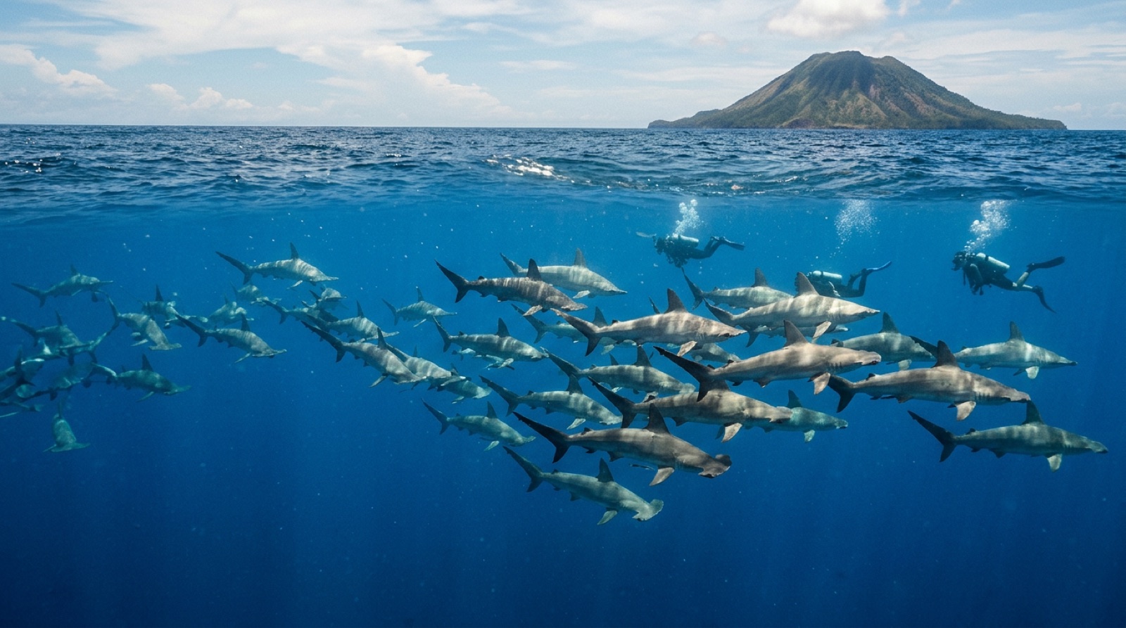
The Banda Sea is deep blue water studded with volcanoes: the nutmeg islands of Banda Neira, snake-swarmed Manuk, and remote ridges where scalloped hammerheads school in season. Most diving happens from liveaboards crossing between Ambon or Saumlaki and points west, in two inter-monsoon windows each year. Ambon itself adds a second act, its sheltered bay holding some of the best muck diving anywhere.
Por qué bucear aquí
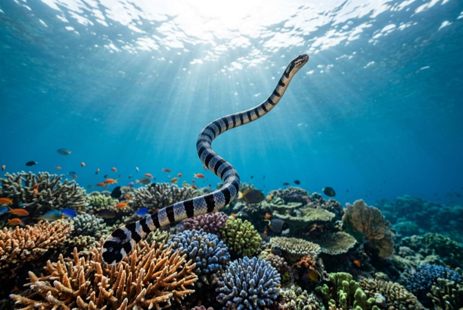
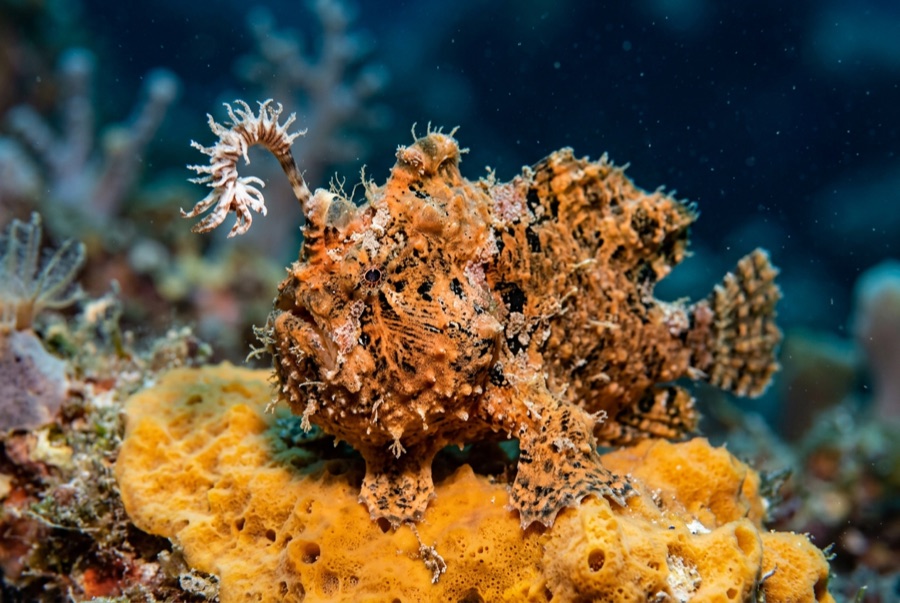
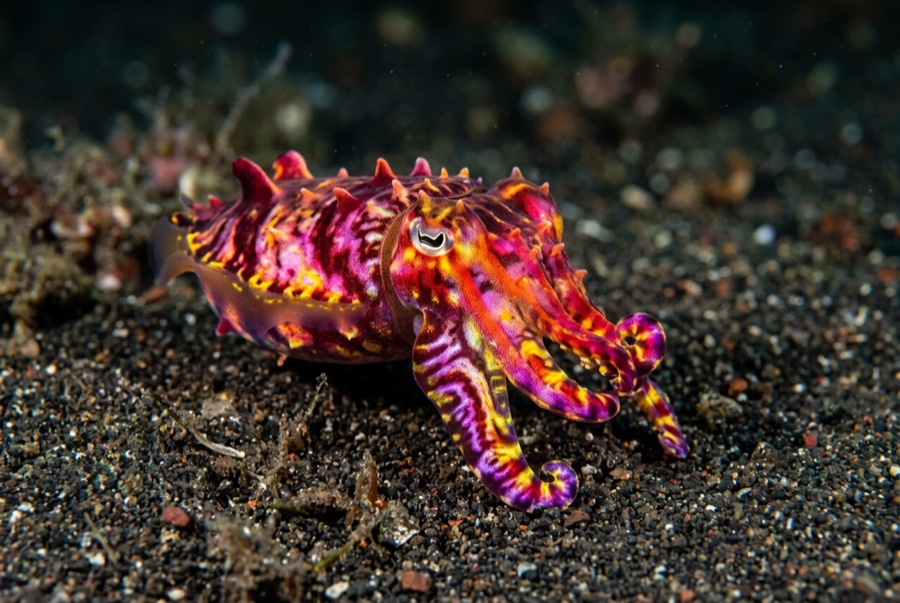
A Banda Sea crossing is part expedition, part history lesson. Boats sail from Ambon past Suanggi and the Banda Islands, where walls at Hatta and Ai drop from busy coral shelves into serious blue, and the 1988 lava flow on Gunung Api now wears a startling regrowth of table corals that scientists have studied as some of the fastest reef recovery recorded. Farther south, sea snakes at Manuk investigate divers by the dozen, entirely unbothered, while schooling scalloped hammerheads shadow the seamounts, most reliably in the September-to-November window. Between dives you walk Banda Neira's nutmeg groves and colonial forts, remnants of the spice trade that once made these islands among the most contested real estate on earth. Bookending the crossing, Ambon Bay's Laha slope serves rhinopias, psychedelic frogfish lore, and cephalopods in classic muck fashion. Long passages and blue-water dives reward experienced divers who like their trips remote.
Mes a mes
Liveaboards cross the Banda Sea in two calm inter-monsoon windows: roughly March to April or early May, and again from about September to November or early December, when hammerhead sightings are at their most reliable. The mid-year southeast monsoon makes open crossings rough and coincides with Ambon's own rains, which fall unusually around June to August; the northwest monsoon around January to February also limits schedules. Ambon Bay's muck sites are sheltered enough to dive most of the year.
| Mes | Agua | Visibilidad | Cómo es |
|---|---|---|---|
| January●●○○○ | 27–30 °C / 81–86 °F | 15–30 m | Northwest monsoon; few boats cross, Ambon muck remains an option. |
| February●●●○○ | 27–30 °C / 81–86 °F | 15–30 m | Late-month calms sometimes open early crossings. |
| March●●●●○ | 27–30 °C / 81–86 °F | 20–40 m | First crossing window; settled seas and clear blue water. |
| April●●●●○ | 27–30 °C / 81–86 °F | 20–40 m | Reliable inter-monsoon diving across the route. |
| May●●●○○ | 27–29 °C / 81–84 °F | 20–35 m | Window narrows as the southeast monsoon approaches. |
| June●●○○○ | 26–29 °C / 79–84 °F | 15–30 m | Rough open water and Ambon's rainy season; crossings pause. |
| July●●○○○ | 26–28 °C / 79–82 °F | 15–30 m | Southeast monsoon peak; liveaboards work other regions. |
| August●●○○○ | 26–28 °C / 79–82 °F | 15–30 m | Still rough; late-month seas begin to relent. |
| September●●●●○ | 26–29 °C / 79–84 °F | 20–40 m | Main season opens; hammerhead encounters pick up. |
| October●●●●● | 27–29 °C / 81–84 °F | 20–40 m | Prime crossing month; calm seas and peak schedules. |
| November●●●●● | 27–30 °C / 81–86 °F | 20–40 m | Excellent conditions; the classic hammerhead window continues. |
| December●●●○○ | 27–30 °C / 81–86 °F | 15–35 m | Early-month trips finish the season before the monsoon turns. |
Confianza en los datos mensuales: Documented. Los meses sin fila no tienen datos verificados — preferimos mostrar un hueco antes que inventar uno.
Los puntos de buceo (6)
| Sitio | Tipo | Profundidad | Nivel | Acceso | |
|---|---|---|---|---|---|
| Batu Kapal Multi-pinnacle architecture; fusilier and triggerfish storms; pelagic… | Pinnacle | 8–40 m | Intermediate | Liveaboard | |
| Hatta Reef Steep walls with heavyweight fish life; bumphead squads; realistic odds of… | Wall | 3–40 m | Intermediate | Liveaboard | |
| Lava Flow Record-pace coral regrowth on young lava; unbroken table-coral fields; the… | Reef | 3–30 m | Beginner | Liveaboard | |
| Manuk Dense, curious sea snakes; an active volcano in open sea; hammerhead odds… | Reef | 5–40 m | Intermediate | Liveaboard | |
| Pulau Ai Glass-clear wall diving; intact hard-coral shelf; easy profiles between the… | Wall | 3–40 m | Beginner | Liveaboard | |
| Twilight Zone (Laha) Rhinopias reliability; the psychedelic frogfish's home ground; jetty debris… | Muck | 2–20 m | Beginner | Boat |
Vida marina con la que puedes planificar
Banded Sea Krait
Frogfish
Flamboyant Cuttlefish
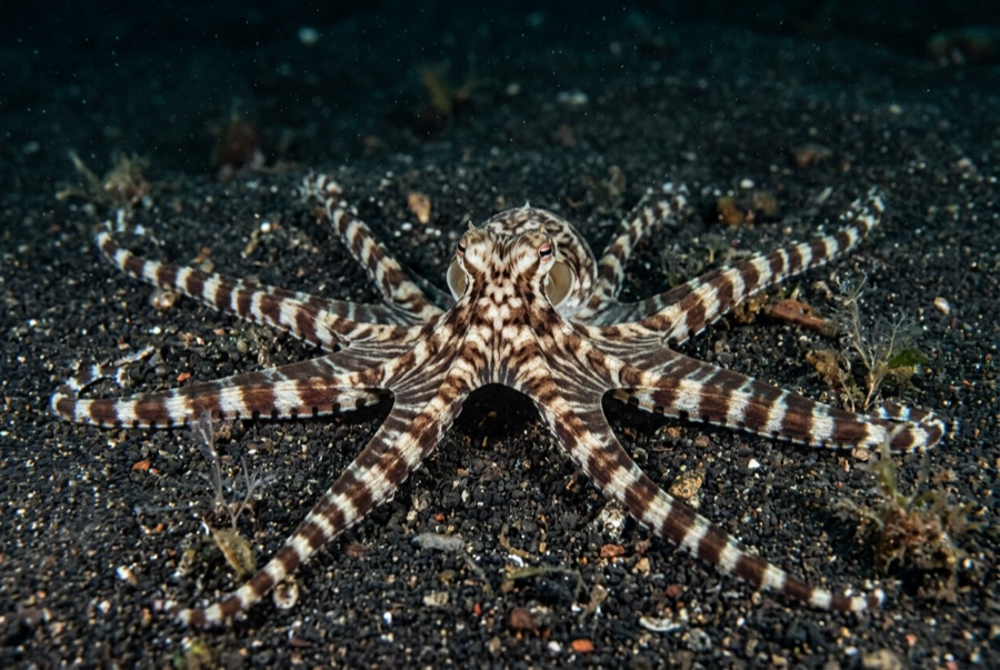
Mimic Octopus
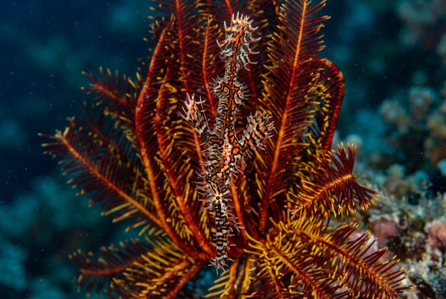
Ornate Ghost Pipefish
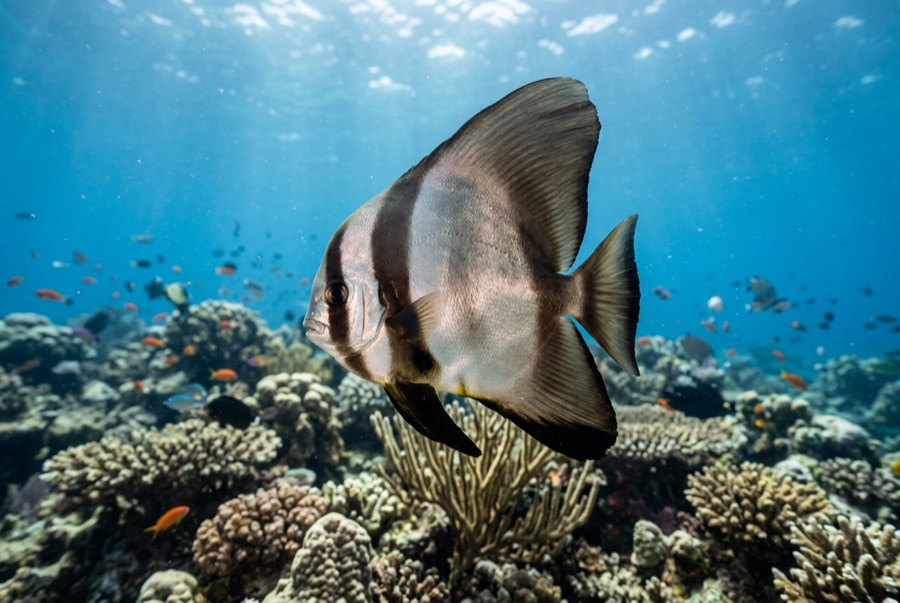
Pinnate Batfish
Scalloped hammerheads in season, sea snakes in remarkable numbers at Manuk, dogtooth tuna, schooling fusiliers and rainbow runners, healthy walls with turtles and Napoleon wrasse, and Ambon Bay's muck bestiary from rhinopias to mimic octopus.
Cómo llegar y dónde alojarse
Cómo llegar: Fly to Ambon via Jakarta or Makassar; most divers board liveaboards there or at Saumlaki. Banda Neira itself is reached by small aircraft on an infrequent schedule or by fast ferry from Ambon, both weather-dependent, so build slack into connections.
Dónde alojarse: Liveaboards are the default. Land-based divers find guesthouses and small dive operations on Banda Neira and around Ambon; comfort is simple and charm is high, particularly in Neira's colonial quarter.
Liveaboards: Classic itineraries run Ambon to Saumlaki or Kaimana and reverse, seven to twelve nights, hitting Suanggi, the Bandas, Manuk, and southern volcanoes; hammerhead-focused departures cluster in September to November. Book a year out for the famous boats.
Costes: This is liveaboard country, priced per night on itineraries of roughly seven to twelve nights; only Ambon and Banda Neira support meaningful land-based diving through small local operators and guesthouses. Flights, marine-park style local fees, and crew gratuities come on top of the berth.
Entre inmersiones: Banda Neira rewards a full day ashore: Fort Belgica, nutmeg plantations, the volcano climb up Gunung Api for the fit, and kora-kora canoe lore. In Ambon, war cemeteries and market visits fill surface days.
Seguridad y aspectos prácticos
Riesgos: Long, exposed passages far from help; blue-water dives with no reference and real depth beneath; currents at the seamounts; venomous sea snakes that must be left to conduct their own inspections. Weather can strand small aircraft and ferries to Banda Neira.
Choose operators with strong safety records for open-sea itineraries, keep hammerhead dives disciplined on depth and group cohesion, and never handle or corner sea snakes, however placid they seem. Evacuation insurance is essential this far out.
Cámara de recompresión más cercana: There is no recompression chamber in the Banda Islands, and facilities in the wider Maluku region are scarce and changeable; serious cases mean long evacuations. Route emergencies through EMS and DAN from the outset.