Nassau & New Providence
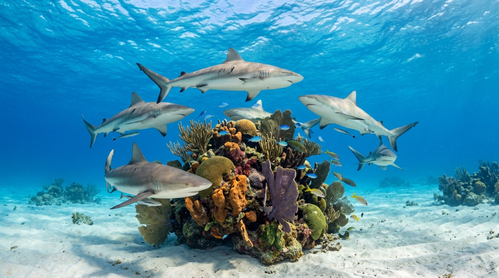
New Providence pairs a busy cruise-port capital with serious diving twenty minutes from the dock. Off the island's southwest corner, the wall drops into the Tongue of the Ocean, a trench well over a kilometer deep, and Caribbean reef sharks patrol it in numbers that made Nassau the self-styled shark-diving capital of the region. Add film-set wrecks, an open blue hole, and year-round logistics, and it earns the title honestly.
Why dive here
Nassau's southwest coast concentrates an unusual amount of variety into one small stretch of wall. Organized feeds at the Shark Arena bring dozens of Caribbean reef sharks within arm's length of kneeling divers, while unbaited wall dives along Runway Wall and Tunnel Wall put the same animals in a wilder mood against blue water. Hollywood left its props behind: the Vulcan bomber rig from Thunderball and the Tears of Allah freighter from Never Say Never Again still sit on the sand, slowly turning into reef. The Ray of Hope, a 200-foot freighter sunk in 2003, gives wreck divers an easy upright hull beside the drop-off. Forty minutes east, nurse sharks pack the sandy rim of the Lost Blue Hole. Flights are plentiful, seas are diveable most of the year, and operators are polished from decades of film and TV work.
Month by month
Diveable year-round. Winter cold fronts can bring wind and chop; late summer carries hurricane risk but also the calmest, warmest water between systems.
| Month | Water | Visibility | What it's like |
|---|---|---|---|
| January●●●●○ | 23–25 °C / 73–77 °F | 20–40 m | Occasional fronts; otherwise superb visibility. |
| February●●●●○ | 23–25 °C / 73–77 °F | 20–40 m | |
| March●●●●● | 24–26 °C / 75–79 °F | 20–40 m | |
| April●●●●● | 25–27 °C / 77–81 °F | 20–40 m | |
| May●●●●○ | 26–28 °C / 79–82 °F | 20–35 m | |
| June●●●●○ | 27–29 °C / 81–84 °F | 15–30 m | |
| July●●●●○ | 28–30 °C / 82–86 °F | 15–30 m | |
| August●●●○○ | 28–30 °C / 82–86 °F | 15–30 m | |
| September●●●○○ | 28–30 °C / 82–86 °F | 15–30 m | Peak hurricane season; watch forecasts. |
| October●●●○○ | 27–29 °C / 81–84 °F | 15–35 m | |
| November●●●●○ | 25–27 °C / 77–81 °F | 20–40 m | |
| December●●●●○ | 24–26 °C / 75–79 °F | 20–40 m |
Monthly figures confidence: Documented. Months without a row have no verified data — we would rather show a gap than invent one.
The dive sites (5)
| Site | Type | Depth | Level | Access | |
|---|---|---|---|---|---|
| James Bond Wrecks Bond film props turned reef, easy depths, frequent shark flybys | Wreck | 9–15 m | Beginner | Boat | |
| Lost Blue Hole Sheer-sided ocean blue hole, piles of nurse sharks on the rim | Blue hole | 12–60 m | Intermediate | Boat | |
| Ray of Hope Upright, open freighter with resident reef sharks in easy depths | Wreck | 8–15 m | Beginner | Boat | |
| Runway Wall True abyssal wall minutes from shore, unbaited shark traffic | Wall | 12–40 m | Intermediate | Boat | |
| Shark Arena Dozens of circling reef sharks at arm's length, adjacent wall dive | Reef | 12–15 m | Intermediate | Boat |
Marine life you can plan around
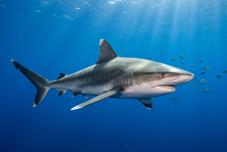
Caribbean Reef Shark
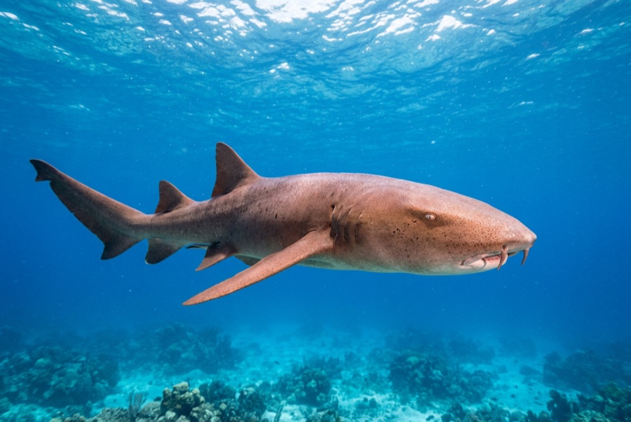
Nurse Shark
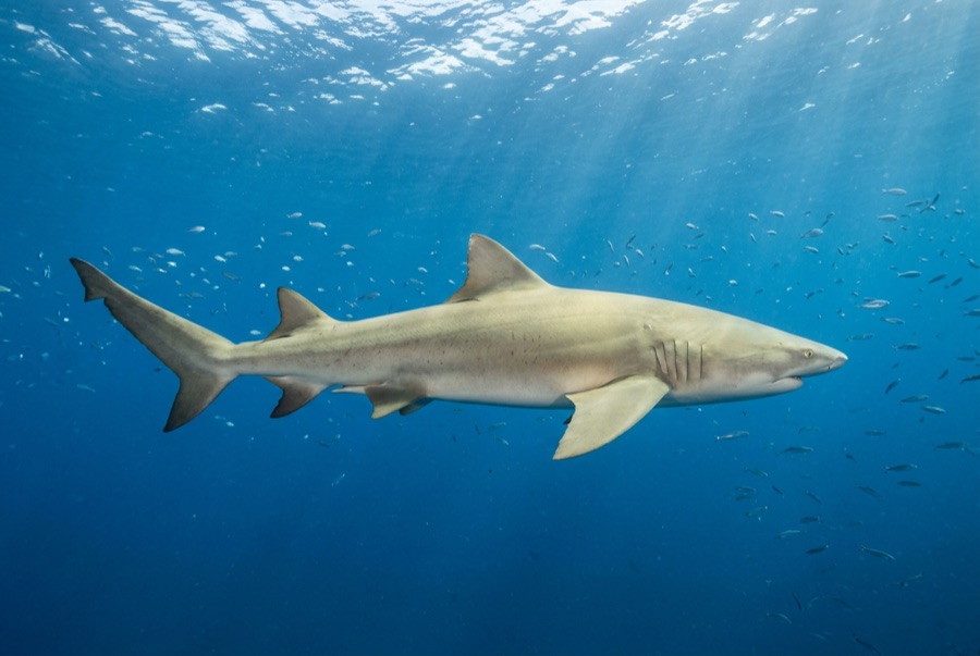
Lemon Shark
Caribbean reef sharks are the signature animal, seen on nearly every wall dive. Nurse sharks crowd the Lost Blue Hole, southern stingrays and eagle rays cross the sand flats, green and hawksbill turtles graze the reef tops, and great barracuda hang over every wreck.
Wrecks here
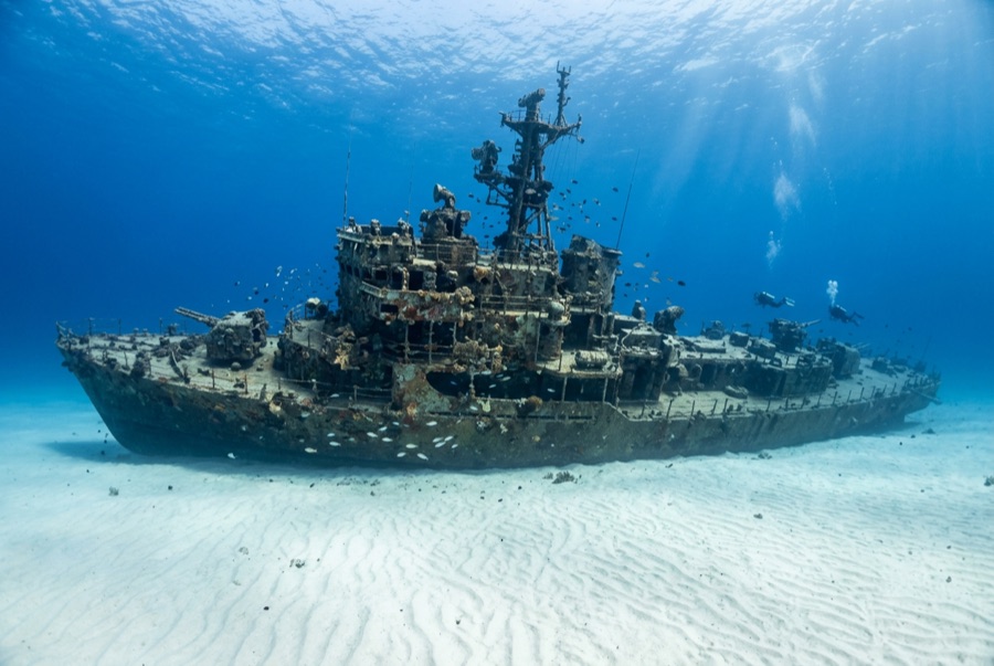
Ray of Hope
Getting there & staying
Getting there: Nassau has direct flights from many US, Canadian, UK, and Caribbean cities. Most dive operators are on the island's south or west side, 20-30 minutes from the airport.
Where to stay: Staying near the southwest coast puts you minutes from the boats; Cable Beach and Paradise Island work if you accept a morning transfer.
Costs: Shark-feed dives and blue hole trips price above standard two-tanks. Editorial estimate; confirm current rates.
Between dives: Beaches, the straw market and colonial forts downtown, Atlantis water parks, and day sails to the Exuma cays.
Safety & practicalities
Hazards: Boat traffic near the harbor and cruise lanes; hurricane season June-November; baited shark dives require disciplined buoyancy and positioning.
On feed dives, kneel where the staff place you and keep hands tucked. On wall dives, watch your depth: the bottom is a very long way down.
Nearest recompression: A recompression chamber has operated in Nassau; availability changes, so emergencies go through EMS and DAN first.