ダイビングスポット、シーズン、海洋生物——調査・マッピング・計画済み。
メニュー
目的地 ダイブサイト マリンライフ 沈船 ニュース
トリップを計画する トリッププランナー ダイビングの時期 費用計算ツール 比較一覧 マリンライフカレンダー 水温 リブアボード オペレーター&リゾート 海洋公園 高気圧酸素治療施設 世界地図
地域一覧 オーストラリア、ニュージーランド&東アジアカリブ海&西大西洋ヨーロッパ・大西洋・地中海インド洋・東アフリカ太平洋諸島&ミクロネシア紅海&中東東南アジア・コーラルトライアングル南北アメリカ・東太平洋 国・地域
学習&ツール 全ガイド ライセンス・資格 器材ガイド 動画 データに聞く AIエージェント API
このサイトについて 私たちについて 調査方法 免責事項 お問い合わせ
表示形式
★ 保存済み

お気に入り登録した目的地・ダイブサイト・生物 — このブラウザに保存されています。

APIゲートウェイ

アトラスのキャッシュデータへの無料・読み取り専用JSONアクセス。

ダークモード

🧭 ガイドビュー
ダイビングを始めたばかりで、水深・流れ・ライセンスレベルについて知りたいですか?閲覧しながらすべての用語をわかりやすく解説しています。同じデータを、サポート付きでご覧いただけます。

⚡ エキスパートビュー
ウォールとドリフトダイブの違いはご存知のはず。データだけを——シンプルに、素早く、コンパクトに。これがデフォルト表示です。

インターフェース言語
Mary Island — illustrative image

Mary Island

Reef · Drift · Blue water 5–35 m Intermediate Solomon Islands, Solomon Islands
AI生成イラスト
ドキュメント済み 別名: Mborokua
水深
5–35 m / 16–115 ft
典型的な水深
18 m / 59 ft
透明度
20–40 m / 66–131 ft
28–30 °C / 82–86 °F
流れ(カレント)
Moderate
アクセス
Liveaboard
推奨認定レベル
Advanced Open Water
典型的なダイビング
~50 min

水深はサイト上部から通常の最大深度までの範囲を示し、「推奨認定レベル」はオペレーターが一般的に求めるメインストリーム機関の資格レベルであり、法的な義務ではありません。流れと透明度は日々変化します——ここに掲載されている情報はすべて計画の目安としてご利用ください。

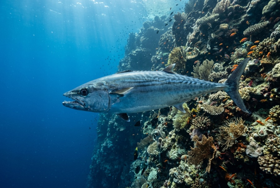
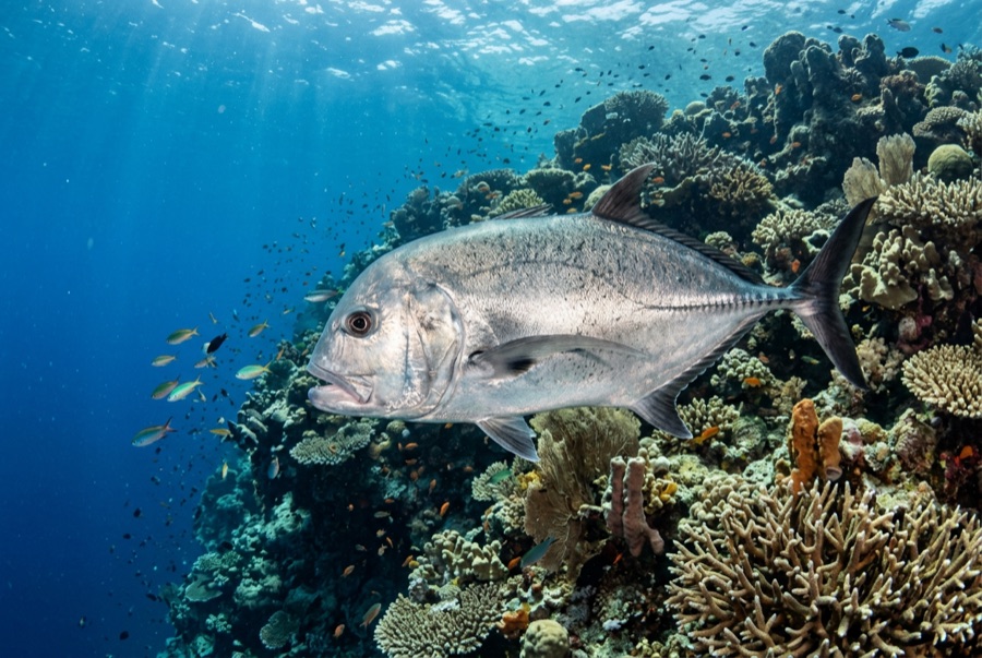
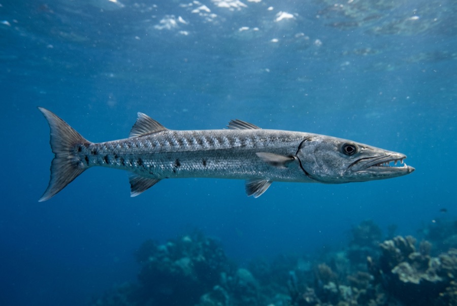
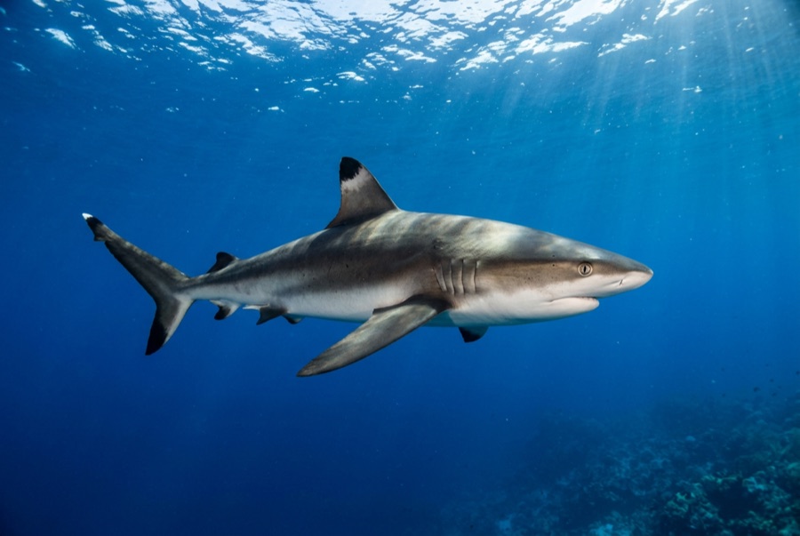
Mary Island — Mborokua on the charts — is an uninhabited volcanic cone in open water, and its points are fish traps in the best sense. Barracuda school here in genuinely huge, rotating columns; bigeye trevally form a second storm below them; and gray reef sharks thread the whole structure while dogtooth tuna make passes from the blue. The reef itself is sturdy rather than delicate, built for the current that feeds it. Dives run as slow drifts along the points, divers tucked against the slope watching traffic. Between the crowds of fish and the absence of any village, the island feels like the Solomons with the volume turned all the way up.

その瞬間のために: Barracuda columns in the thousands; trevally storms; steady gray reef shark traffic on the points.

地形: Steep volcanic reef slopes and points dropping into deep, clear open water

流れ(カレント): The points concentrate flow, and the fish concentrate with it.

エントリー: An uninhabited volcanic island between the Russells and the New Georgia group; liveaboard territory, dived on the points where current runs.

エントリー前に知っておこう

危険生物・リスク: Current on the points; open-water exposure and long liveaboard distances from help.

保全: An unpopulated island whose reefs stay rich precisely because visits are few — no anchoring on the points, no take of any kind.

ナイトロックス: ここでは効果的です——このエリアのプロファイルは、ナイトロックスが無減圧潜水時間を有意に延ばせる水深帯にあります(適切なトレーニングを受けていることが前提です)。

出会える生物
水中フォトグラファー向け

ワイドアングル: ★★★★★ · マクロ: ★☆☆☆☆ — 各撮影スタイルに対するこのサイトの評価(編集部による1〜5点)

オーストラリア、ニュージーランド&東アジア

Cairns & the Ribbon ReefsNingaloo ReefCoral Sea & Osprey ReefOkinawa & the Kerama IslandsPoor Knights IslandsTownsville & the YongalaGreen IslandIzu Peninsula

カリブ海&西大西洋

BonaireCozumelRiviera Maya & the CenotesBelize Barrier ReefGrand CaymanIsla Mujeres & CancúnRoatánTiger Beach & Grand Bahama

ヨーロッパ・大西洋・地中海

Malta & GozoSilfra & IcelandThe AzoresCanary IslandsLarnaca & the ZenobiaScapa FlowArctic NorwayMadeira

インド洋・東アフリカ

North & South Malé AtollsAri AtollBaa Atoll & Hanifaru BayAliwal Shoal & UmkomaasMafia IslandMauritiusSeychellesSodwana Bay

太平洋諸島&ミクロネシア

PalauChuuk (Truk) LagoonFakaravaKona, HawaiʻiRangiroaTaveuni & Rainbow ReefBeqa Lagoon & Pacific HarbourEspiritu Santo

紅海&中東

Sharm El Sheikh & Ras MohammedBrothers, Daedalus & St John'sDahabHurghada & El GounaMarsa Alam & the Deep SouthAqabaDaymaniyat IslandsMusandam Peninsula

東南アジア・コーラルトライアングル

Bali & Nusa PenidaKomodoRaja AmpatSipadan & MabulAnilaoCoronKoh TaoLembeh Strait

南北アメリカ・東太平洋

Galápagos IslandsCocos IslandFlorida KeysSea of Cortez & Cabo PulmoSocorro & the RevillagigedosBritish ColumbiaCalifornia Channel IslandsCosta Rica Pacific Coast