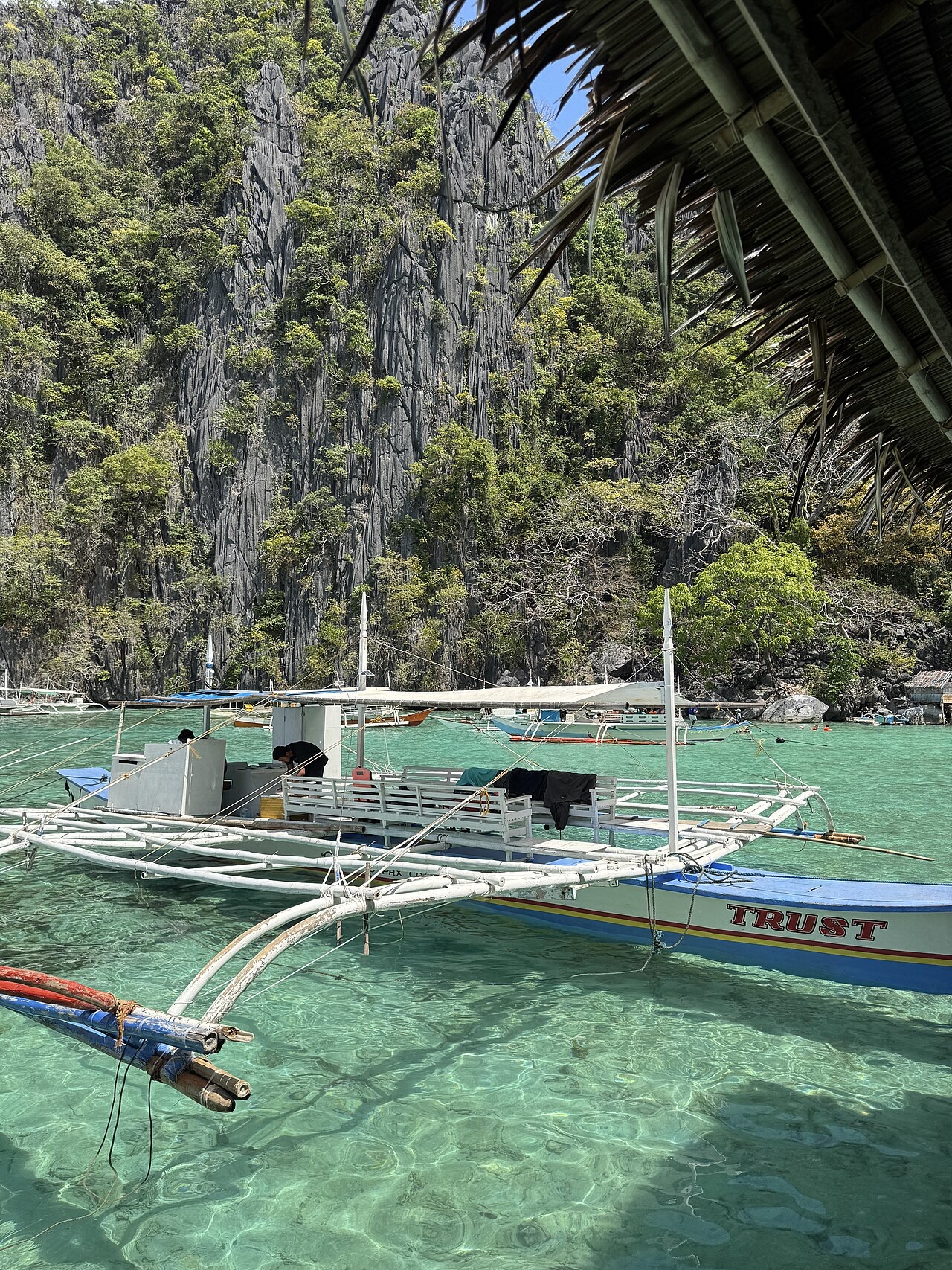
Coron
Coron, on Busuanga in northern Palawan, holds Southeast Asia's most accessible fleet of large shipwrecks. On 24 September 1944, US carrier aircraft caught Japanese auxiliary vessels sheltering in these bays and sank them at recreational depths, where a dozen hulls now sit wrapped in coral and glassfish. Between wreck days, divers climb into Barracuda Lake's surreal hot layers and drift over shallow reef gardens beneath karst cliffs.
Warum hier tauchen
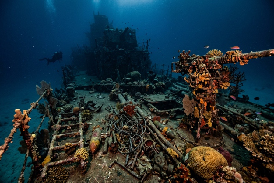
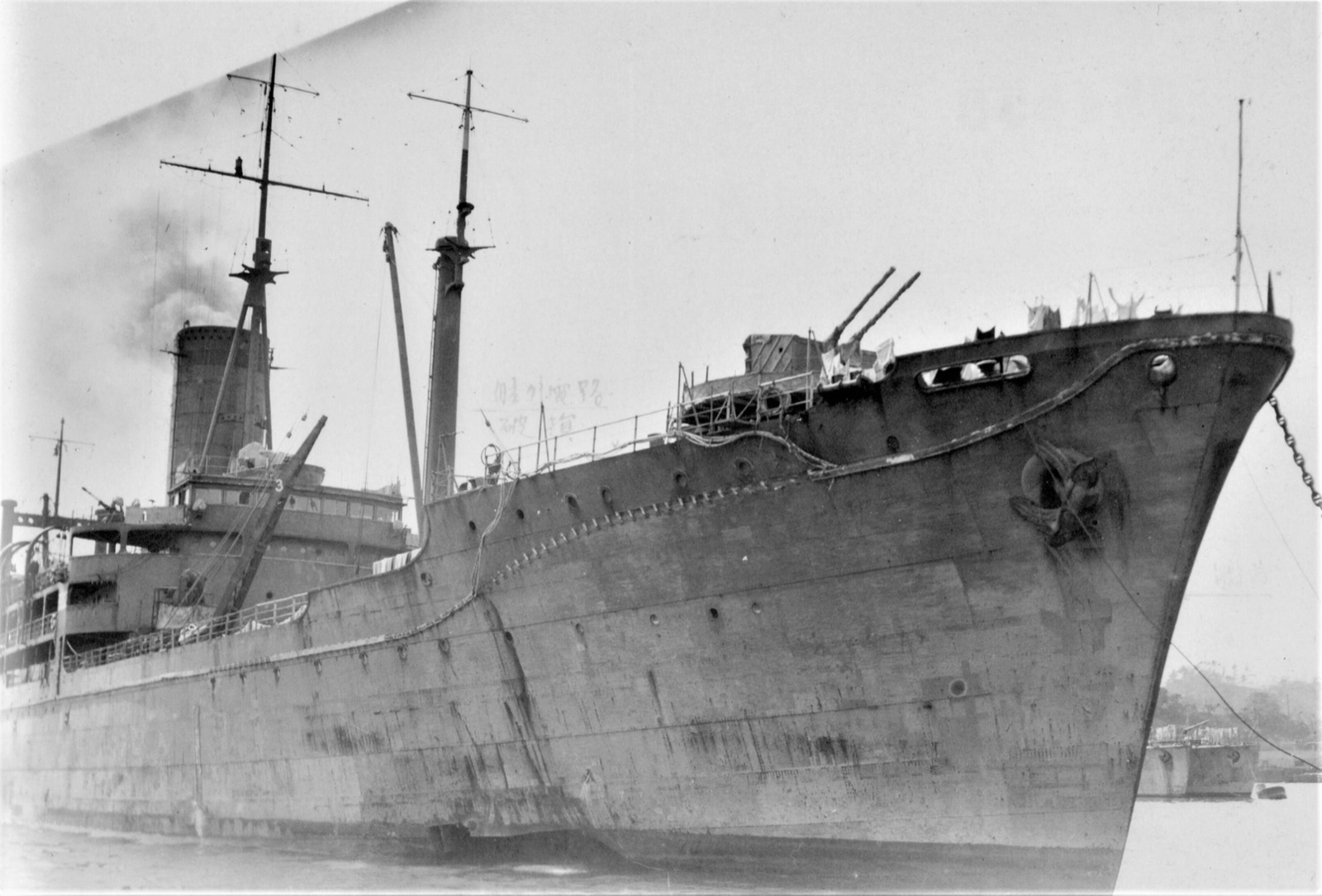
This is wreck diving with history you can touch and depths most certifications can reach. The ships of the 24 September 1944 air strike lie minutes to an hour from town: the towering refrigeration ship Irako for experienced divers, the long shallow deck of the tanker Okikawa Maru for everyone else, and the warship Akitsushima with its collapsed seaplane crane in between. Engine rooms, cargo holds with cement bags and construction gear, and corridors full of glassfish reward every level of penetration training, while soft corals and batfish own the exteriors. Visibility is honest rather than heroic, often 5-15 m, which suits the moody, monumental feel. Between wrecks, Barracuda Lake's limestone bowl serves a 38-degree thermocline you will talk about for years, and Siete Pecados' shallow gardens show what protection has done for the nearshore reef. Treat the fleet respectfully: crews died in these hulls, and artifacts stay where they lie.
Monat für Monat
Wrecks are dived year-round in the sheltered bays. November to May is the dry, calm season; June to October brings rain, runoff, and typhoon-watch weather that can pause outer sites more than the inner fleet.
| Monat | Wasser | Sichtweite | Wie es sich anfühlt |
|---|---|---|---|
| January●●●●● | 26–28 °C / 79–82 °F | 8–18 m | Dry season; the bay at its clearest and calmest. |
| February●●●●● | 26–29 °C / 79–84 °F | 8–18 m | Settled weather and easy schedules across the fleet. |
| March●●●●● | 27–30 °C / 81–86 °F | 8–18 m | Warm and reliable; a favorite month for penetration courses. |
| April●●●●○ | 28–30 °C / 82–86 °F | 8–18 m | Hot season; Holy Week fills boats. |
| May●●●●○ | 28–31 °C / 82–88 °F | 5–15 m | First rains arrive; wrecks stay diveable. |
| June●●●○○ | 28–30 °C / 82–86 °F | 5–12 m | Wet season begins; runoff dims the inner bay. |
| July●●●○○ | 28–30 °C / 82–86 °F | 5–12 m | Rainy pattern; sheltered hulls keep working. |
| August●●●○○ | 28–30 °C / 82–86 °F | 5–12 m | Showers and the odd blow; flexible itineraries help. |
| September●●●○○ | 28–30 °C / 82–86 °F | 5–12 m | Late monsoon; watch typhoon tracks. |
| October●●●○○ | 28–30 °C / 82–86 °F | 5–15 m | Transition month with improving stretches. |
| November●●●●○ | 27–29 °C / 81–84 °F | 8–15 m | Drying out; conditions rebuild toward high season. |
| December●●●●○ | 26–29 °C / 79–84 °F | 8–18 m | Calm returns and holiday traffic picks up. |
Konfidenz der Monatswerte: Documented. Monate ohne Zeile haben keine verifizierten Daten. Wir zeigen lieber eine Lücke, als eine zu erfinden.
Die Tauchplätze (7)
| Tauchplatz | Typ | Tiefe | Level | Zugang | |
|---|---|---|---|---|---|
| Akitsushima Genuine warship history, the seaplane crane, atmospheric side-lying hull… | Wreck | 20–38 m | Advanced | Boat | |
| Barracuda Lake A 38 °C thermocline you can feel like a wall, cathedral rock formations… | Freshwater | 3–35 m | Intermediate | Shore | |
| Irako Coron's most intact major wreck, famed engine-room penetration for the… | Wreck | 28–45 m | Advanced | Boat | |
| Kogyo Maru Cargo holds with cement and machinery, readable wartime purpose… | Wreck | 22–36 m | Intermediate | Boat | |
| Okikawa Maru Shallow sprawling tanker deck, coral-and-anemone overgrowth, approachable… | Wreck | 10–26 m | Intermediate | Boat | |
| Olympia Maru Batfish escorts and glassfish clouds, forgiving depths, an ideal first… | Wreck | 12–30 m | Intermediate | Boat | |
| Siete Pecados Thriving shallow coral, giant clams and turtles, the area's best… | Reef | 1–12 m | Beginner | Boat |
Meeresleben, das du einplanen kannst
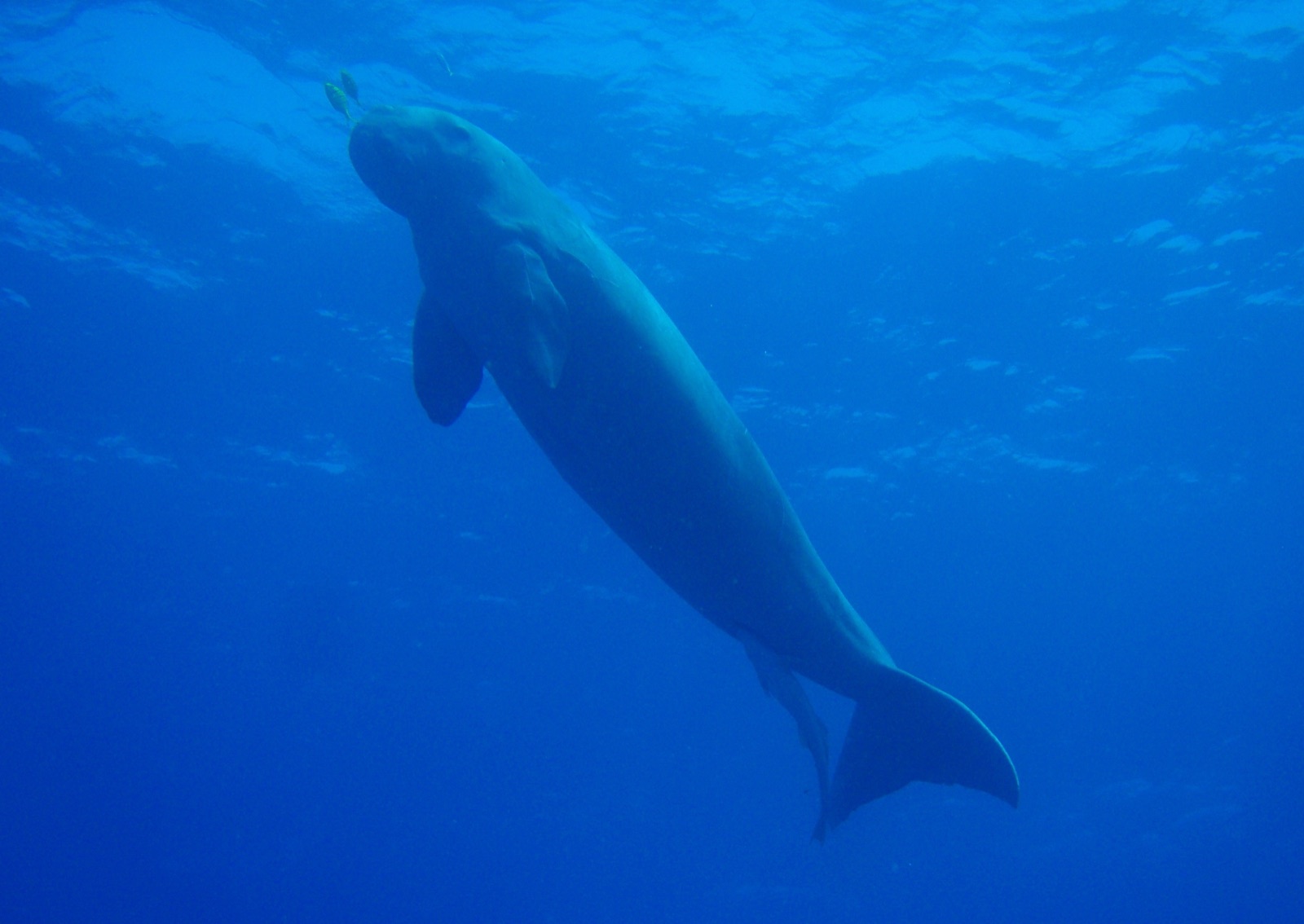
Wreck communities of glassfish, batfish, scorpionfish, and grouper; nudibranchs and shrimp for macro eyes; turtles and giant clams on the shallow reefs; dugongs live around greater Busuanga, though sightings on dive sites are uncommon.
Wracks hier
Akitsushima
Irako
Kogyo Maru
Okikawa Maru
Olympia Maru
Anreise & Unterkunft
Anreise: Fly about an hour from Manila to Busuanga, then transfer 30-40 minutes by van to Coron town; ferries also connect from El Nido. Wreck sites lie 20 minutes to 1.5 hours out by banca.
Wo übernachten: Coron town has the widest spread of guesthouses, dive centers, and restaurants; a few island resorts sit closer to the western wrecks. Book ahead in the December-April high season.
Kosten: Day-boat wreck trips typically bundle two or three dives with lunch for roughly US$60-110 depending on distance; wreck-penetration specialties and tec support are widely available and priced separately.
Zwischen den Tauchgängen: Island-hopping among Coron Island's lagoons, Kayangan Lake's viewpoint, hot springs near town, and karst scenery that fills memory cards without a regulator.
Sicherheit & Praktisches
Gefahren: Overhead environments with silt, sharp steel, and monofilament on every major wreck; depth on Irako and Akitsushima; limited visibility; occasional current between islands.
Penetration belongs to divers with wreck training, lights, and a guide who knows the hull; plenty of world-class diving here needs no overhead at all. Watch bottom time on the deeper fleet and consider nitrox for repetitive wreck days.
Nächste Rekompressionskammer: No chamber operates locally; the nearest facilities are in Manila and Cebu, a flight or long evacuation away. Availability changes; all emergencies via EMS and DAN.