发现去哪里潜水、何时出发,以及你可能看到什么。

发现去哪里潜水、何时出发,以及你可能看到什么。
★
菜单
目的地 潜点 海洋生物 沉船 资讯
规划一次旅行 行程规划 最佳潜水时机 费用计算器 对比 海洋生物日历 水温 船宿 运营商与度假村 海洋公园 高压氧舱 世界地图
洞穴潜水 全部洞穴潜水 目的地与潜点 洞穴系统与地图 训练与资质 潜水中心与向导 装备与技术 安全与事故研究 科学、历史与保护 资源与更新
地区 澳大利亚、新西兰与东亚加勒比海与西大西洋欧洲、大西洋与地中海印度洋与东非太平洋岛屿与密克罗尼西亚红海与中东东南亚与珊瑚三角区美洲与东太平洋 目的地国家
学习与工具 所有指南 潜水认证 装备指南 视频 数据问答 AI智能体 API
关于 关于我们 方法论 免责声明 联系
您的视图
★ 已收藏

您收藏的目的地、潜点和物种,均存储在本浏览器中。

API网关

免费只读JSON接口,访问图鉴缓存数据。

深色模式

引导视角
刚接触潜水?对深度、水流、认证等级有疑问?在浏览过程中,我们用简单易懂的语言解释每个术语。数据相同,帮助已内置其中。

专家视角
峭壁和漂流潜水的区别您已经清楚。这里只有数据,简洁、直接、紧凑,这是默认视图。

界面语言
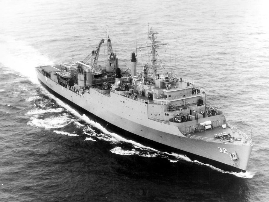
The U.S. Navy dock landing ship USS Spiegel Grove (LSD-32) underway at sea, circa the 1960s or early 1970s.

USS Spiegel Grove

Wreck 14–40 m Advanced Florida Keys, United States
照片: U.S. Navy · Public domain
记录详尽
深度
14–40 m / 46–131 ft
典型深度
27 m / 89 ft
能见度
10–30 m / 33–98 ft
水况
22–31 °C / 72–88 °F
水流
Moderate
访问
Boat
建议证书等级
Advanced Open Water; wreck training for any penetration

深度范围指从潜点顶部到通常最大深度;"建议认证等级"是运营商通常要求的主流机构等级,并非法律规定。水流和能见度每天都会变化,请将这里的所有信息视为规划参考范围。

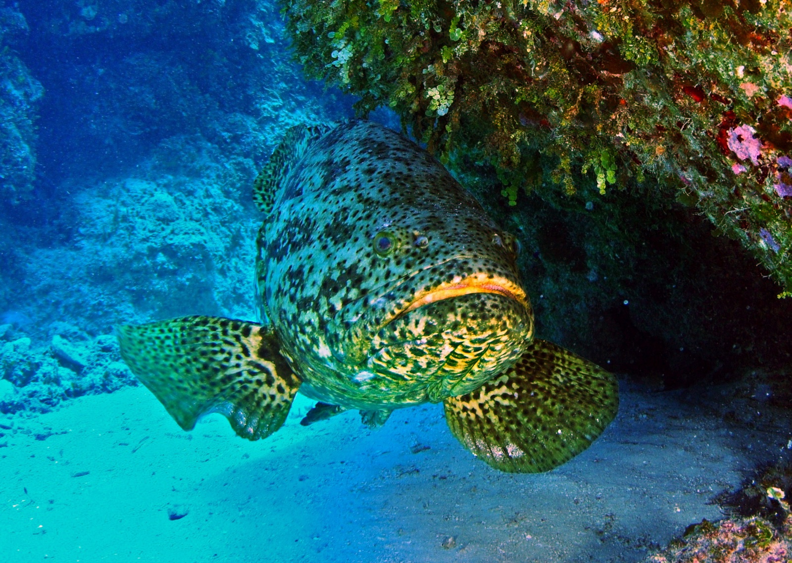
The Spiegel Grove's story is half the dive: the 155 m landing ship dock sank prematurely and rolled in 2002, was wrestled onto her side, and then Hurricane Dennis in 2005 did what salvage crews could not, setting her upright on the sand. She is enormous - divers speak of visiting neighborhoods rather than seeing the ship - with cranes, a cavernous well deck, and passageways prepared for trained wreck divers. Superstructure begins around 14-18 m, the sand lies at roughly 40 m, and goliath groupers the size of loveseats guard the shadows while barracuda hang in the current above. Multiple moorings, multiple dives, and most Key Largo regulars still have not seen all of her.

您此行的高光时刻: One of the largest ships ever intentionally reefed, resident goliath groupers, the hurricane-righting story

地形地貌: 155 m landing ship dock upright on sand at about 40 m

水流: Current over the wreck varies from slack to ripping; descend and ascend on the mooring lines.

本站是一艘已标注的沉船 USS Spiegel Grove, Thomaston-class dock landing ship (LSD-32), 沉没于 2002. 完整沉船历史与潜水指南 →

入水前须知

危险因素: Depth, current, and a genuine overhead environment for anyone leaving the exterior; monitor gas and deco margins.

保育: An FKNMS artificial reef; mooring buoys mandatory, artifact removal prohibited.

高氧(Nitrox): 在此值得使用:这些潜点的深度范围内,富氧空气(nitrox)能有效延长免减压停留时间,前提是您已接受相关培训。

你会遇见谁

附近亦有记录

"已标注于此"的物种由编辑团队从本页所列来源中整理收录。数量为GBIF出现记录数:即1990年以来在标注位置约5公里范围内记录的观测数据,仅与我们目录中的物种进行匹配。这些数据反映的是该地点的历史目击情况,并非对您此行所见的保证。

摄影师专区

广角: ★★★★★ · 微距: ★☆☆☆☆ (编辑对该潜点适合各类水下摄影风格的1–5分评级)

澳大利亚、新西兰与东亚

Cairns & the Ribbon ReefsNingaloo ReefCoral Sea & Osprey ReefOkinawa & the Kerama IslandsPoor Knights IslandsTownsville & the YongalaGreen IslandIzu Peninsula

加勒比海与西大西洋

BonaireCozumelRiviera Maya & the CenotesBelize Barrier ReefGrand CaymanIsla Mujeres & CancúnRoatánTiger Beach & Grand Bahama

欧洲、大西洋与地中海

Malta & GozoSilfra & IcelandThe AzoresCanary IslandsLarnaca & the ZenobiaScapa FlowArctic NorwayMadeira

印度洋与东非

North & South Malé AtollsAri AtollBaa Atoll & Hanifaru BayAliwal Shoal & UmkomaasMafia IslandMauritiusSeychellesSodwana Bay

太平洋岛屿与密克罗尼西亚

PalauChuuk (Truk) LagoonFakaravaKona, HawaiʻiRangiroaTaveuni & Rainbow ReefBeqa Lagoon & Pacific HarbourEspiritu Santo

红海与中东

Sharm El Sheikh & Ras MohammedBrothers, Daedalus & St John'sDahabHurghada & El GounaMarsa Alam & the Deep SouthAqabaDaymaniyat IslandsMusandam Peninsula

东南亚与珊瑚三角区

Bali & Nusa PenidaKomodoRaja AmpatSipadan & MabulAnilaoCoronKoh TaoLembeh Strait

美洲与东太平洋

Galápagos IslandsCocos IslandFlorida KeysSea of Cortez & Cabo PulmoSocorro & the RevillagigedosBritish ColumbiaCalifornia Channel IslandsCosta Rica Pacific Coast