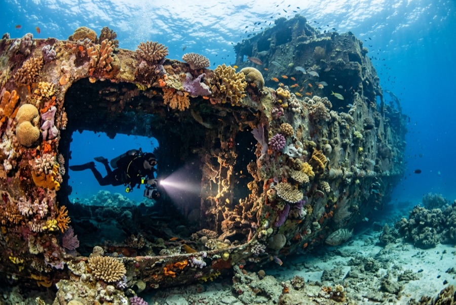
Doña Marilyn
水深はサイト上部から通常の最大深度までの範囲を示し、「推奨認定レベル」はオペレーターが一般的に求めるメインストリーム機関の資格レベルであり、法的な義務ではありません。流れと透明度は日々変化します——ここに掲載されている情報はすべて計画の目安としてご利用ください。
The Doña Marilyn was an inter-island passenger ferry lost in Typhoon Unsang in October 1988, a disaster that killed a large number of the people aboard; accounts of the toll vary into the hundreds. The roughly 90 m hull now lies on its starboard side on sand at about 33 m, thickly furred in black coral and soft growth, sheltering scorpionfish, sweetlips, and clouds of baitfish, with rays sometimes resting in its lee. Dive it as what it is, a grave as well as a reef: no souvenirs, restrained penetration for the trained only, and quiet respect for the door frames people once walked through.
その瞬間のために: A large, coral-carpeted ferry hull, rich fish life, sobering history handled respectfully
地形: Hull lying on its starboard side on sand at about 33 m
流れ(カレント): Exposed position; current across the hull is common and dives are planned around it.
エントリー: Roughly an hour's boat ride from Malapascua in open water; dived when seas allow.
エントリー前に知っておこう
危険生物・リスク: Depth, nets and snagged lines in places, silt inside, and open-sea current; penetration only with wreck training.
保全: Treat as a maritime grave: take nothing, disturb nothing, and keep contact off the hull's growth.
ナイトロックス: ここでは効果的です——このエリアのプロファイルは、ナイトロックスが無減圧潜水時間を有意に延ばせる水深帯にあります(適切なトレーニングを受けていることが前提です)。
出会える生物
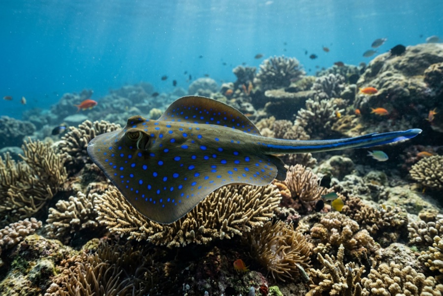
Blue-Spotted Ribbontail Ray
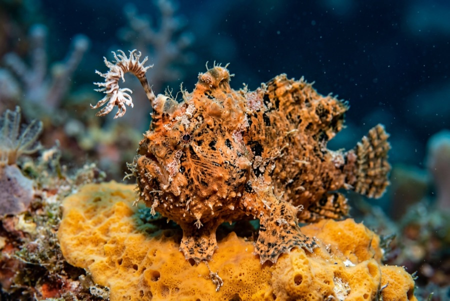
Frogfish
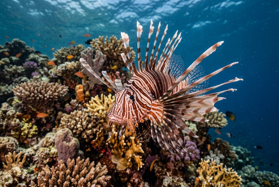
Lionfish

Nudibranchs
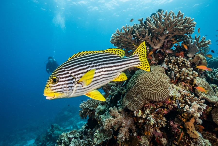
Oriental Sweetlips
水中フォトグラファー向け
ワイドアングル: ★★★★☆ · マクロ: ★★★☆☆ — 各撮影スタイルに対するこのサイトの評価(編集部による1〜5点)