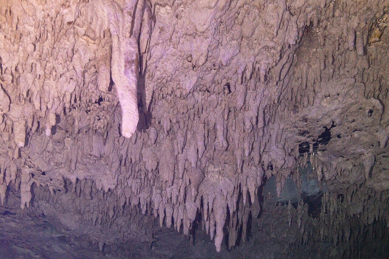
Bagaimana gua yang terendam air terbentuk, dan mengapa hal itu penting
8 panduan237 tonggak sejarah yang tercatat tanggalnya
Cara gua terendam terbentuk, air dan kehidupan di dalamnya, apa yang tersimpan dari masa lalu, cara gua dieksplorasi dan dipetakan, serta cara akses dan perlindungan dinegosiasikan.
5 panduan
Sains
Archaeology and palaeontology in underwater caves
Why flooded caves preserve Ice Age evidence, and what has been found: Naia and the extinct fauna of Hoyo Negro,...
Groundwater, haloclines and water quality in flooded caves
How karst aquifers move water through caves, what haloclines and anchialine waters are, why visibility changes with...
How underwater caves are surveyed and studied
An introduction to underwater cave survey: line surveys with stations, distance, compass bearing and depth; why...
How underwater caves form: karst, dissolution and drowned passages
An introduction to the geology of flooded caves: how acidic water dissolves limestone, the difference between young...
Life in flooded caves: stygofauna, remipedes and the diver's footprint
What lives in underwater caves, from remipedes discovered by a cave diver in 1979 to blind fish and methane-fed...
1 panduan
Sejarah dan eksplorasi
2 panduan
Konservasi dan akses
Conservation, landowners and responsible access
How access to underwater caves depends on landowners and managers, with documented examples: Wakulla and Peacock...
Threats to underwater caves today, and how they are protected
A dated overview of documented pressures on underwater caves: wastewater and nitrate, Tren Maya construction over...
237 tonggak sejarah
Linimasa eksplorasi
| Tanggal | Sistem | Apa yang terjadi |
|---|---|---|
| 1580 | Hranice Abyss | First written mention of the abyss, by Tomáš Jordán of Klausenburg. |
| 1856 | Molnár János Cave | János Molnár explores the dry passages above the spring lake. |
| 1878-03 | Fontaine de Vaucluse | Helmet diver Nello Ottonelli reaches 23 m. |
| 1915 | Lake Otjikoto | German forces dumped weapons and ammunition into the lake while surrendering. |
| 1924 | Gruta do Lago Azul | The cave was found by Terena Indigenous people, according to a show-cave reference. |
| 1928-09-23 | Pozzo del Merro | The Circolo Speleologico Romano explores the sinkhole. |
| 1935 | Wookey Hole | Balcombe and others publish 'The Great Cave of Wookey Hole' survey after the early diving work. |
| 1946 | Wookey Hole | Graham Balcombe founds the Cave Diving Group. |
| 1946-08-27 | Fontaine de Vaucluse | Cousteau and Dumas reach 46 m in the first self-contained dives at the spring. |
| 1954 | Source de Saint-Sauveur | Y. Dufour and Guy de Lavaur dive the cave. |
| 1955 | Chinhoyi Caves | The site was designated a National Park. |
| 1956 | Peacock Springs cave system | First recorded cave dive into the Peacock system. |
| 1957 | Blauhöhle system (Blautopf) | Divers reach the bottom of the Blautopf at 22 m. |
| 1957 | Divje jezero | B. Rupnik and M. Straus make the first dive and find a flooded gallery at the bottom of the lake. |
| 1960 | Lucayan Caverns | Anglican priest Father Underhill came across the cavern and told diver Ben Rose, who explored it with his brother. |
| 1961 | Cocklebiddy Cave | Western Australian Speleological Group divers made the first dive and found a submerged tunnel about 200 m from the entrance. |
| 1963 | Hranice Abyss | Divers descend to 42 m. |
| 1964 | Pozo Azul | Joaquim and Pere Plana of the Grupo Espeleológico Edelweiss make the first dives. |
| 1968 | Tuna-Hästberg Mine (Äventyrsgruvan) | Mining ends and pumping stops; the lower workings flood. |
| 1968 | Émergence du Ressel | Divers from the Groupe Spéléo Auvergnat (Debras and Martin) make the first recorded exploration, to about 150 m. |
| 1969 | Wookey Hole | The CDG produces its survey of Wookey '20'. |
| 1970 | Abismo Anhumas | The cave was discovered by chance after a forest fire on the former Fazenda Anhumas, according to the operator. |
| 1970 | Kingsdale system (Keld Head) | Alan Erith dies in Keld Head. |
| 1971 | Great Blue Hole | Jacques Cousteau's Calypso expedition charted the hole and recovered stalactites from its submerged caves. |
| 1972 | Gouls de Tourne | The GEPS (Marseille) reaches 40 m depth 730 m into the Goul de la Tannerie. |
| 1972 | Komati Springs | The mine was abandoned and flooded, according to a South African diver's account. |
| 1972 | Lake Otjikoto | The lake was declared a national monument. |
| 1972 | Långban Mine | The mine closes and floods after the pumps are switched off. |
| 1974 | Fontaine de Vaucluse | After a survey dive to 78 m by divers from Angoulême, the municipality prohibits all diving. |
| 1974 | Sistema Gleda–Camp des Pou | The Speleo Club Mallorca surveys the Cova de sa Gleda entrance area. |
| 1975 | Chinhoyi Caves | The site was designated a Recreational Park. |
| 1975 | Font del Truffe | Daniel Andrès and Bertrand Léger explore more than 500 m of passage beyond sump 4, after Brive divers had reached 680 m. |
| 1975 | Peacock Springs cave system | Sheck Exley discovered the Crypt, a collapsed section of tunnel named for the remains of a large turtle found there. |
| 1975-08 | Émergence du Ressel | J.-L. Camus reaches about 300 m and 30 m depth, stopping at the top of the shaft. |
| 1976 | Cocklebiddy Cave | A joint WA/SA team reached the air-filled Rockfall Chamber. |
| 1976 | Sistema Gleda–Camp des Pou | The Speleo Club Mallorca surveys the Avenc des Camp des Pou. |
| 1977-08 | Émergence du Ressel | Fantoli and Touloumdjian reach 45 m depth about 350 m from the entrance. |
| 1978 | Gruta do Lago Azul | IPHAN listed the cave as protected heritage. |
| 1978 | Kingsdale system (Keld Head) | Jochen Hasenmayer sets a European sump-penetration record at Keld Head. |
| 1978 | Maaras resurgence (Aggitis Cave) | Pascal Reilé and Vincent Cordier pass the 8 m first sump and survey 300 m of dry passage beyond. |
| 1978-12-22 | Hranice Abyss | The Czech Speleological Society group ZO 7-02 Hranický kras is founded. |
| 1979 | Kingsdale system (Keld Head) | A through-dive connects Keld Head and Kingsdale Master Cave. |
| 1979 | Peacock Springs cave system | By the end of the 1970s NSS-CDS members had surveyed the system to 20,293 feet, then the longest known system of its kind. |
| 1979-09 | Font del Truffe | A French team progresses to sump 11. |
| 1980 | Pluragrotta–Steinugleflåget system | First known deep dive in the cave, by Svein Grundstrøm and Bjørn Fagertun. |
| 1980-07-29 | Source de Saint-Sauveur | Eric and Francis Le Guen stop at 78 m, 350 m from the entrance. |
| 1981 | Divje jezero | P. Krivic and A. Praprotnik reach 200 m from the entrance at 83 m depth. |
| 1981 | Lucayan Caverns | Jill Yager described Speleonectes lucayensis from Lucayan Cavern and established the new crustacean class Remipedia. |
| 1981 | Manantial de la Aleta | José Guerrero identified the Manantial de la Aleta during a brief survey sponsored by the Museo del Hombre Dominicano. |
| 1982 | Gouls de Tourne | Bertrand Léger reaches 113 m at 1,020 m in the Tannerie in solo trimix dives. |
| 1982-03 | Lucayan Caverns | The Bahamas National Trust signed a 99-year lease creating Lucayan National Park over the cave area. |
| 1982-09 | Cocklebiddy Cave | A WA/SA team led by Hugh Morrison reached Toad Hall and found the third sump. |
| 1983 | Maaras resurgence (Aggitis Cave) | Sump 4 is passed; 4,280 m of passage is known. |
| 1983-03 | Lucayan Caverns | The park was closed to all but scientists and qualified divers with Trust permission, reopening to the public in 1985. |
| 1983-09 | Cocklebiddy Cave | A French team led by Eric Le Guen used scooters to push about 1.46 km into the third sump, a world record for underwater penetration at the time. |
| 1983-09-09 | Fontaine de Vaucluse | Jochen Hasenmayer dives solo to 205 m. |
| 1983-10 | Cocklebiddy Cave | A combined Australian team went about 240 m beyond the French limit, with Hugh Morrison reaching a point about 6.24 km from the entrance. |
| 1985 | Blauhöhle system (Blautopf) | Jochen Hasenmayer reaches the Mörikedom air chamber about 1,200 m into the cave. |
| 1985 | Gruta do Lago Azul | The first gate restricting unlimited tourist access was installed. |
| 1985 | Jacob's Well cave | After drownings and a near-fatal recovery attempt, recreational scuba diving at Jacob's Well halted. |
| 1985 | Peacock Springs cave system | The Nature Conservancy bought 250 acres around the springs to protect the forest and caves. |
| 1985 | Wookey Hole | Rob Parker reaches 68 m using trimix, ending at a gravel slope. |
| 1985-08-02 | Fontaine de Vaucluse | The robot Modexa lands on a sandy floor at 315 m. |
| 1986 | Dragon's Breath Cave | Cavers first explored the cave. |
| 1986 | Source de Saint-Sauveur | Xavier Goyet dies returning from a deep exploration dive. |
| 1987 | Wakulla-Leon Sinks cave system | Bill Stone's US Deep Caving Team mapped 13,100 feet in Wakulla Spring between October and December and tested a prototype closed-circuit rebreather. |
| 1987 | Wakulla-Leon Sinks cave system | Big Dismal, Little Dismal and nearby sinks became part of the Leon Sinks Geological Area, which restricted diving access. |
| 1988 | Lake Guinas | Boetie Scheun reached 132 m on the eastern side. |
| 1988 | Olhos de Água do Alviela | Patrick Jolivet reaches about 580 m from the entrance at -98 m. |
| 1988 | Réseau de l'Ouysse (Cabouy – Pou Meyssen) | An account of exploration from Pou Meyssen by Arnefaux is published on the FFS-hosted site. |
| 1988-04-04 | Boesmansgat | Diaan Hanekom and Nuno Gomes dived to 123 m. |
| 1990-08-12 | Émergence du Ressel | Olivier Isler makes the first crossing of sump 1. |
| 1991-05 | Émergence du Ressel | German-led survey campaigns begin; they continue until 2005. |
| 1991-06 | Kingsdale system (Keld Head) | Rupert Skorupka's team, diving downstream from King Pot, joins lines with divers working upstream. |
| 1991-08 | Kingsdale system (Keld Head) | A 3,000 m through-trip between King Pot and Keld Head is completed. |
| 1992 | Gruta do Lago Azul | Brazilian and French divers found Pleistocene mammal bones on the lake floor. |
| 1992 | Maaras resurgence (Aggitis Cave) | Local authorities develop part of the cave for public visits. |
| 1993 | Peacock Springs cave system | The state of Florida, having acquired the land, opened Peacock Springs State Park to the public. |
| 1993-08 | Boesmansgat | Sheck Exley reached 263 m, the first diver to reach the bottom. |
| 1994 | Green Waterhole - Tank Cave system | CDAA divers extended the mapped cave by several hundred metres, bringing mapped passage to close to six kilometres. |
| 1994 | Wakulla-Leon Sinks cave system | WKPP received a Special Use Permit to explore Wakulla Springs. |
| 1994-10-30 | Font del Truffe | Bernard Gauche advances 130 m into sump 12. |
| 1995 | Abismo Anhumas | The cave opened to visitors, according to the operator. |
| 1995 | Cocklebiddy Cave | An Australian team led by Chris Brown reached a point about 6.26 km from the entrance, where the passage continued as a low, tight squeeze. |
| 1995 | Poço Azul | Submerged fossil bones were discovered in the cave. |
| 1996 | Gouls de Tourne | Olivier Isler and a Franco-Swiss team reach 165 m in the Tannerie. |
| 1996 | Great Blue Hole | The site was declared the Blue Hole Natural Monument. |
| 1996-02 | Divje jezero | Olivier Isler reaches 122 m depth, 335 m from the entrance. |
| 1996-06 | Wakulla-Leon Sinks cave system | WKPP divers connected Big Dismal Sink to upstream Cheryl Sink, making Leon Sinks the most extensive underwater cave then known in the US. |
| 1996-08-23 | Boesmansgat | Nuno Gomes reached 282.6 m on a solo dive lasting about twelve hours. |
| 1997 | Blauhöhle system (Blautopf) | ARGE Blautopf is formed and receives a diving permit for research. |
| 1997 | Maaras resurgence (Aggitis Cave) | Under a limited permit the team reaches a confluence at 5,871 m and surveys 8,544 m. |
| 1997 | Sistema Gleda–Camp des Pou | The Grup Nord de Mallorca begins systematic diving exploration of the Gleda. |
| 1998 | Lagoa Misteriosa | Diver Gilberto Menezes de Oliveira reached 220 m without seeing the bottom. |
| 1998 | Pozzo del Merro | Divers G. Caramanna and R. Malatesta reach 70 m in a Sapienza University research programme supported by the fire brigade. |
| 1998 | Poço Azul | Ezio Rubbioli published a topographic map of the cave in an article on cave diving in the Bahia backlands (O Carste 10(1)). |
| 1999 | Abismo Anhumas | The current management took over the attraction, according to the operator. |
| 1999 | Eagle's Nest Sink cave | The Southwest Florida Water Management District banned diving after acquiring the land. |
| 1999 | Komati Springs | Divers extended the line on the level at about 110 m to roughly 190 m from the base of the shaft. |
| 1999 | Lake Guinas | Nuno Gomes reached 123 m. |
| 1999 | Pozzo del Merro | Further dives reach 100 m below the lake surface. |
| 1999 | Émergence du Ressel | Divers reach the end of what was then called sump 5. |
| 2000 | Divje jezero | Tomo Vrhovec reaches about 135 m. |
| 2000 | Jacob's Well cave | Research dives by trained cave divers began, in a project with the Wimberley Valley Watershed Association and the San Marcos Area Rescue Team. |
| 2000-04 | Pozzo del Merro | Fire-brigade ROVs reach 200 m and then 310 m without touching bottom. |
| 2000-12 | Hranice Abyss | Krzysztof Starnawski reaches 181 m. |
| 2001 | Source de Saint-Sauveur | Rick Stanton finds a window in the former terminal dead end and descends to 103 m (610 m). |
| 2002 | Manantial de la Aleta | Beeker, Conrad and Foster reported 245 artefacts recovered from depths of 40 to 71 m. |
| 2002 | Molnár János Cave | A new passage is discovered, including a hall charted at about 86 m long, 27 m wide and 15 m high. |
| 2002 | Olhos de Água do Alviela | A CNPS-FFESSM expedition with Portuguese cavers re-lines and surveys 1,370 m and reaches -125 m. |
| 2002 | Padre Nuestro Complex | Beeker, Conrad and Foster published the archaeology of Cueva de Chicho and the Padre Nuestro complex in the Journal of Caribbean Archaeology. |
| 2002-03 | Pozzo del Merro | A fire-brigade ROV from Milan touches the floor at 392 m. |
| 2002-05 | Gouls de Tourne | The Fils d'Ariane team clears the blocked entrance of the Goul du Pont. |
| 2002-09 | Pozo Azul | Jason Mallinson extends sump 2 to about 1,950 m at 60 m depth. |
| 2003-07 | Eagle's Nest Sink cave | The state lifted the diving ban once a management plan for the site was developed. |
| 2003-08 | Fontaine de Vaucluse | SSFV divers working with the archaeology service recover about 400 antique pieces; a 2004 campaign brings the total above 1,600. |
| 2004 | Jacob's Well cave | Teams began surveying and mapping the submerged cave. |
| 2004 | Sawmill Sink | Cave diver Brian Kakuk found a tortoise skeleton in the sink, the first of its major fossil finds. |
| 2004 | Wookey Hole | A team led by Rick Stanton and John Volanthen begins dives that reach 90 m by 2005, a British depth record. |
| 2004-08 | Source de Saint-Sauveur | A further 70 m is added at around 120 m depth, stopping at 133 m with the way on open. |
| 2004-10 | Boesmansgat | Dave Shaw reached 270 m on a rebreather and located the body of a diver lost in the 1990s. |
| 2005 | Fontaine de Vaucluse | Thomas Soulard (SSFV) dives to 125 m to explore the Prado gallery and shows it joins the main shaft. |
| 2005 | Lagoa Misteriosa | The attraction was closed for lack of an environmental licence. |
| 2005 | Långban Mine | First dives in the flooded shafts; Långbans Dyksällskap is founded with the Värmland Museum. |
| 2005 | Poço Azul | A specialised cave-diving team recovered the fossils from depths of up to 16.5 m. |
| 2005-01 | Boesmansgat | Dave Shaw died during the recovery attempt; his support diver survived with serious decompression illness. |
| 2006 | Blauhöhle system (Blautopf) | A connection between the Blautopfhöhle and the Vetterhöhle provides a dry access route. |
| 2006-01 | Sawmill Sink | Researchers collected three sediment cores from the sink for fossil and plant analysis. |
| 2006-04 | Gouls de Tourne | Xavier Méniscus reaches 185 m in the Goul du Pont. |
| 2006-06-26 | Source de Saint-Sauveur | The Conseil général du Lot temporarily restricts diving to the pool after rockfall at the restriction. |
| 2007 | Jacob's Well cave | The Jacob's Well Exploration Project was formally created by volunteer cave divers. |
| 2007 | Pearse Resurgence | Dave Apperley and Rick Stanton extended the known cave from 125 m to 177 m depth. |
| 2007-01 | Sistema Sac Actun | QRSS recorded the final underwater connection between Sac Actun and Sistema Nohoch Nah Chich, with Sac Actun then described as the longest underwater cave known. |
| 2007-02-03 | Font del Truffe | Rick Stanton and John Volanthen climb a narrow fissure in sump 12 and find sump 13. |
| 2007-03 | Sistema Toh Ha | Toh Ha was connected to Chumkopo Antigua and then to Chan Hol, becoming the fifth-longest underwater cave in Quintana Roo according to QRSS. |
| 2007-04 | Sistema Toh Ha | Toh Ha was connected to Sac Be Ha. |
| 2007-07 | Sistema Ox Bel Ha | QRSS recorded the connection to Yax Chen East, giving 164.4 km and describing Ox Bel Ha as the longest underwater cave then known. |
| 2007-12 | Sawmill Sink | Steadman and colleagues published the Sawmill Sink fossil assemblage in the Proceedings of the National Academy of Sciences. |
| 2007-12 | Wakulla-Leon Sinks cave system | Jarrod Jablonski and Casey McKinlay traversed from Turner Sink to Wakulla Spring, proving that the Leon Sinks and Wakulla caves are one system. |
| 2008-05 | Gouls de Tourne | Rick Stanton, supported by John Volanthen, reaches 220 m in the Tannerie. |
| 2008-06 | Lake Guinas | Nuno Gomes and Pieter Venter dived to the eastern-side bottom at 105 m for a film expedition. |
| 2008-06 | Wakulla-Leon Sinks cave system | WKPP divers reached 25,766 feet from the Wakulla Spring entrance in Q-tunnel. |
| 2008-08 | Cocklebiddy Cave | A team including Craig Challen and Richard Harris used rebreathers and scooters to extend the line by about 120 m. |
| 2008-08 | Lagoa Misteriosa | Thirteen cave divers supervised by Tuta Barroco mapped the shaft to 70 m for a management plan to be submitted to Ibama. |
| 2009 | Komati Springs | Divers found new passages and a room nicknamed the Dragon's Cage off the level at about 107 m. |
| 2009 | Sawmill Sink | The National Geographic-funded Bahamas Blue Hole Expedition, led by Kenny Broad with the National Museum of The Bahamas, worked in Abaco's blue holes including Sawmill Sink. |
| 2009 | Stargate Blue Hole | Divers on the National Geographic Bahamas Blue Hole Expedition worked in Stargate; Brian Kakuk had explored the North Passage about 400 m from the shaft and pushed into the South Passage. |
| 2009 | Tuna-Hästberg Mine (Äventyrsgruvan) | The economic association Äventyrsgruvan takes over operations and equipment from the volunteer group Baggbodykarna. |
| 2009-03 | Sistema Toh Ha | Baab Zotz was connected to Toh Ha. |
| 2009-08 | Sistema Xunaan Ha | Xunaan Ha absorbed Chan Chemuyil Sur and X'cacel. |
| 2009-12 | Sistema Xunaan Ha | Palomita Spring and Xunaan Ha Two were connected to Xunaan Ha. |
| 2010 | Green Waterhole - Tank Cave system | The CDAA bought the land over the Tank Cave entrance. |
| 2010 | Jacob's Well cave | Jacob's Well Natural Area was established. |
| 2010 | Sistema Gleda–Camp des Pou | By this year the survey shows the Gleda connected with the Avenc des Camp des Pou. |
| 2010 | Sistema Xunaan Ha | X'cacel Pequeña (July) and Renzo (November) were connected to Xunaan Ha. |
| 2010-08 | Maaras resurgence (Aggitis Cave) | Luigi Casati dives the S4 bis side sump for 1,130 m to -63 m with a low point at -68 m; the cave reaches 11,800 m. |
| 2010-08 | Pluragrotta–Steinugleflåget system | Finnish divers dive the sumps of Steinugleflåget after carrying rebreathers down the dry cave. |
| 2011 | Blauhöhle system (Blautopf) | Arbeitsgemeinschaft Blaukarst breaks through from its Hessenhau dig into a large river cave later shown by dye tracing to feed the Blautopf. |
| 2011 | Peacock Springs cave system | The park was renamed Wes Skiles Peacock Springs State Park. |
| 2011 | Pearse Resurgence | An exploration and biosurvey expedition reached 194 m. |
| 2011-01 | Sistema Sac Actun | Sac Actun was connected to Sistema Aktun Hu on 30 January 2011; QRSS then gave 215,246 m of underwater passage. |
| 2011-05 | Sistema Ox Bel Ha | Naranjal was connected to Ox Bel Ha. |
| 2011-07 | Lagoa Misteriosa | IMASUL issued an operating licence on 22 July 2011 and the site reopened to visitors later that month. |
| 2011-11-11 | Réseau de l'Ouysse (Cabouy – Pou Meyssen) | Franck Gentili and Renaud Cabanne begin replacing the guideline in sump 1. |
| 2011-12 | Sistema K'oox Baal | Tux Kupaxa, Sac K'tu Cha and Balam T'sal sump were connected to K'oox Baal, then described as the seventh-longest cave in Mexico. |
| 2012 | Komati Springs | Lines were extended in further new passages off the same level. |
| 2012 | Pearse Resurgence | Exploratory dives reached 221 m. |
| 2012-10-01 | Hranice Abyss | Starnawski reaches 223 m and lowers a probe to 373 m. |
| 2012-12 | Sistema Sac Actun | QRSS noted a dry connection between Dos Ojos and Sac Actun (Pet Cemetery area). |
| 2012-12-20 | Gruta do Lago Azul | IMASUL authorised contemplative tourist visits with a daily cap of 305 visitors. |
| 2012-12-28 | Font del Truffe | John Volanthen, Martin Groves and Rupert Skorupka explore to sump 14. |
| 2013 | Kingsdale system (Keld Head) | John Cordingley extends Keld Head to within 300 m of Large Pot. |
| 2013-05 | Chinhoyi Caves | Chinhoyi Caves was designated a Ramsar Wetland. |
| 2013-08 | Hinatuan Enchanted River Underwater Cave System | FCD Expedition V re-dived the cave to the end of the permanent line and documented a recent ceiling collapse. |
| 2014-02-06 | Pluragrotta–Steinugleflåget system | Two Finnish divers die in the deep section; three others are treated for decompression sickness. |
| 2014-03-31 | Pluragrotta–Steinugleflåget system | The Helgeland police chief lifts the access ban placed on the Plura caves after the accident. |
| 2014-04 | Sistema Carwash | QRSS joined the Carwash spring and siphon caves as Sistema Carwash. |
| 2014-06-08 | Gouls de Tourne | Xavier Méniscus extends the Tannerie to 240 m, nearly 1.5 km from the entrance. |
| 2014-08 | Cueva Quebrada | QRSS recorded the connection of Sistema Dos Coronas to Cueva Quebrada. |
| 2014-08-16 | Source de Saint-Sauveur | Xavier Méniscus extends the terminus by 150 m to a maximum depth of 195 m on a 13-hour dive. |
| 2014-11-26 | Réseau de l'Ouysse (Cabouy – Pou Meyssen) | The last section of new line is laid, to the end of the lake before sump 2. |
| 2015 | Dan's Cave System | Steve Bogaerts and Brian Kakuk connected Dan's Cave with Ralph's Cave, creating one combined system. |
| 2015 | Sistema Gleda–Camp des Pou | At the end of the year the Conselleria refuses permission to continue work, halting it for more than three years. |
| 2015 | Wookey Hole | Chamber 20, formerly reached only by divers, is opened to show-cave visitors via a blasted 70 m tunnel. |
| 2015-03 | Hinatuan Enchanted River Underwater Cave System | FCD, the University of San Carlos, DENR-BMB and GIZ planned a rapid source assessment and mapping of the system. |
| 2015-07 | Dragon's Breath Cave | Divers reached probably 132 m, the deepest dive for the next nine years. |
| 2015-08 | Pozo Azul | Mallinson finds and dives a sixth sump, raising the cave's development above 13,700 m. |
| 2015-08-21 | Hranice Abyss | Starnawski reaches 265 m, the deepest point reached by a diver at the site. |
| 2016 | Dan's Cave System | A National Geographic-backed project began a complete resurvey of Dan's and Ralph's Caves. |
| 2016 | Pearse Resurgence | Exploration reached 229 m in one tunnel. |
| 2016 | Poço Azul | A paper in Terrae Didatica described the laboratory preparation of the Eremotherium laurillardi skeleton. |
| 2016-05 | Pawod Underwater Cave System | Filipino Cave Divers surveyed the cave with support from the Philippine Commission on Sports Scuba Diving, mapping 258.42 m. |
| 2016-06 | Sistema K'oox Baal | A connection to Muul Tun Spring made K'oox Baal the third-longest underwater cave in Mexico, according to QRSS. |
| 2016-09 | Hinatuan Enchanted River Underwater Cave System | FCD published a biophysical survey of the Enchanted River. |
| 2016-09 | Sistema Carwash | QRSS list entry updated to 3,232 m. |
| 2016-09 | Sistema Toh Ha | Cave explorers surveying Chan Hol under INAH permits found the Chan Hol 3 human skeleton. |
| 2016-09-27 | Hranice Abyss | A remotely operated vehicle from Gral Marine reaches 404 m water depth. |
| 2016-10 | Sistema K'oox Baal | K'oox Baal was connected to Tres Cruces. |
| 2017-02 | Eagle's Nest Sink cave | FWC convened a meeting with cave-diving organisations, training agencies, DAN and the IUCRR on keeping Chassahowitzka WMA dive sites open. |
| 2017-08 | Sistema Taj Mahal | QRSS list entry updated to 9,954 m (M. Nebenhaus). |
| 2018 | Green Waterhole - Tank Cave system | Divers connected Tank Cave with Green Waterhole (Fossil Cave). |
| 2018 | Sistema Ox Bel Ha | CINDAQ began a systematic resurvey of the system, starting from about 245 km of mapped passage. |
| 2018-01 | Sistema Sac Actun | The Gran Acuífero Maya project announced the underwater connection with Sistema Dos Ojos, giving a combined 347 km. |
| 2018-08 | Eagle's Nest Sink cave | New rules took effect requiring scuba divers to be at least 18 and to register online before every dive, according to press reports. |
| 2018-12 | Great Blue Hole | A submarine expedition led by Aquatica Submarines mapped the hole with sonar and reported a hydrogen sulfide layer near 90 m. |
| 2019 | Dragon's Breath Cave | Stone Aerospace's SUNFISH autonomous vehicle mapped the lake and followed its tunnel to 205 m. |
| 2019 | Harasib Cave | The SUNFISH autonomous vehicle mapped the flooded shaft and chamber to about 265 m. |
| 2019 | Lake Guinas | The SUNFISH autonomous vehicle mapped the lake to 133 m. |
| 2019-05-25 | Sistema Gleda–Camp des Pou | Work resumes under the Societat Espeleològica Balear. |
| 2019-07 | Sistema K'oox Baal | Cangrejo was connected to K'oox Baal. |
| 2019-08 | Pozo Azul | A Pegasus Caving Club team uses an underwater habitat and radio beacons to support dives towards the far end of sump 2 (Tipperary). |
| 2019-11 | Sistema Dos Pisos | QRSS list entry updated to 14,756 m (Berni/Sieff). |
| 2020 | Lucayan Caverns | The most recent exploration recorded by the Grand Bahama Museum was carried out by Kewin Lorenzen and Cristina Zenato. |
| 2020 | Pearse Resurgence | The Wet Mules team reached 245 m in a second tunnel. |
| 2020-07 | Sistema Ox Bel Ha | QRSS reported Regina connected to Ox Bel Ha through a deep area between the Regina and Maya Blue sections. |
| 2021-01-20 | Gruta do Lago Azul | The federal Secretariat of Union Property authorised ceding the cave to the municipality of Bonito for 20 years. |
| 2021-03 | Boesmansgat | Karen van den Oever reached 236.04 m with support from a South African club. |
| 2022-07-12 | Gruta do Lago Azul | IMASUL approved the Natural Monument's management plan. |
| 2022-08 | Hranice Abyss | Water depth measured at about 450 m by the Czech Speleological Society without reaching the bottom. |
| 2022-10-27 | Boesmansgat | Karen van den Oever reached 246.56 m, listed by Guinness World Records as the deepest scuba dive by a woman. |
| 2023-01 | Wakulla-Leon Sinks cave system | WKPP divers connected Chip's Hole cave to the system, bringing the surveyed total to 236,723 feet. |
| 2024 | Ojamo Mine | Ojamon kaivossukeltajat ry receives operating rights to the mine pond from the City of Lohja. |
| 2024-02 | Sistema Ox Bel Ha | QRSS reported Sistema Ni Ha connected to Ox Bel Ha and said Cenote Ni Ha had reportedly been buried under the railway right-of-way. |
| 2024-05-19 | Blauhöhle system (Blautopf) | The surveyed length of the Blauhöhle passes 18 km. |
| 2024-06 | Dragon's Breath Cave | A German-led rebreather team reached about 157-160 m. |
| 2024-06 | Lake Guinas | A German cave-diving team dived to 113 m, one diver reaching 130 m. |
| 2024-06 | Lake Otjikoto | A visiting German cave-diving team dived the lake with Namibian divers. |
| 2024-12 | Sistema Ox Bel Ha | CINDAQ reported a total confirmed length of 524 km at the end of 2024, with just over 40 km left to resurvey. |
| 2024-12 | Sistema Sac Actun | QRSS list entry updated to 379,569 m underwater with a maximum depth of 119.2 m. |
| 2025 | Harasib Cave | An expedition report states that a team diving in Namibia since 2017 had reached 179 m in the system. |
| 2025 | Molnár János Cave | A new lead from survey point D12 yields about 200 m of passage, bringing the surveyed length to 6,225 m. |
| 2025 | Sistema Ox Bel Ha | CINDAQ reported 30,001 m of new exploration and 113,342 m of resurvey during 2025. |
| 2025 | Tapolca cave system | Research divers make two dives to check and begin replacing the fixed lines and markers. |
| 2025-01 | Sistema K'oox Baal | QRSS reported that a push from Xunaan Ha came very close to, but did not make, a connection with K'oox Baal. |
| 2025-01 | Sistema Xunaan Ha | QRSS reported a push from Xunaan Ha that came very close to connecting with K'oox Baal. |
| 2026-01 | Ojamo Mine | A club diver dies during the ascent on the open-water side after a mine dive; the cause is investigated. |
| 2026-08 | Wakulla-Leon Sinks cave system | WKPP reported a Wakulla Basin Mapping Initiative season with the Sunfish autonomous vehicle, which 3D-mapped 4.63 miles of passage. |
Setiap tonggak sejarah bersumber dari halaman sistem terkait.
9 organisasi
Organisasi survei, riset, dan konservasi
Bahamas Caves Research Foundation
A Bahamas-based group of scientists, explorers and conservationists that explores and documents blue holes and...
Cave Divers Association of Australia
An Australian membership body that negotiates access to cave-diving sites with landowners, rates sites by category,...
Centro Investigador del Sistema Acuífero de Quintana Roo
A Mexican non-profit civil association (A.C.) of cave explorers that maps the underground rivers of Quintana Roo and...
Howard T. Odum Florida Springs Institute
A science and education non-profit in High Springs, Florida, that monitors spring flow and water quality, studies...
Karst Waters Institute
A US non-profit research institute whose mission is to improve the fundamental understanding of karst water systems...
National Speleological Society
The US membership organisation for cavers, founded in 1941, which supports cave science, conservation and...
Quintana Roo Speleological Survey
A survey archive, created in 1990, that compiles confirmed survey data for the underwater and dry caves of Quintana...
U.S. Deep Caving Team
An exploration organisation founded in 1980 by Bill Stone that runs long expeditions to deep caves and develops...
Woodville Karst Plain Project
A volunteer, non-profit exploration and research project that explores, surveys and documents the flooded caves...
Makalah dan sumber
| Judul | Penulis atau penerbit | Tahun |
|---|---|---|
| Basic Cave Diving: A Blueprint for Survival ↗Exley's classic accident-analysis booklet, now offered free by the NSS Cave Diving Section in English and Spanish.... | Sheck Exley | 1979 |
| The Wakulla Springs Project ↗Expedition summary of the 1987 Wakulla Springs Project: team, objectives, the underwater habitat, tunnel-by-tunnel exploration... | William C. Stone (editor) | 1989 |
| Karst Information Portal (KIP) Articles collection ↗A free, searchable collection of records and full texts of karst and cave research papers, including several key works on... | University of South Florida Libraries | 2026 |
| Long Underwater Caves in Quintana Roo (QRSS list) ↗A ranked table of surveyed underwater cave systems in Quintana Roo with lengths in metres, number of cenotes and the teams... | Quintana Roo Speleological Survey | 2025 |
| U/Th dated speleothems from submerged caves in the northeastern Yucatan Peninsula ↗Open dataset of 48 uranium-thorium ages on 14 stalagmites collected by divers from flooded caves around Tulum, used to... | Simon D. Steidle, Sophie Warken, Nils Schorndorf, Julius Förstel, Andrea Schröder-Ritzrau, Gina E. Moseley, Christoph Spötl, Jeronimo Aviles, Wolfgang Stinnesbeck, Norbert Frank | 2021 |
| World Remipedia Database ↗The taxonomic database for remipedes, the cave crustaceans first discovered by a cave diver in The Bahamas in 1979, with... | Stefan Koenemann (editor), Mario Hoenemann, Torben Stemme | 2026 |
| CINDAQ Annual Report 2025 ↗Annual report covering the Ox Bel Ha resurvey, exploration in the Sian Ka'an Biosphere Reserve, archaeology projects with INAH... | CINDAQ (Centro Investigador del Sistema Acuífero de Quintana Roo) | 2026 |
| Cave development on the Caribbean coast of the Yucatan Peninsula, Quintana Roo, Mexico ↗Explains why Quintana Roo's flooded caves form a distinct type, dissolved where fresh and salt groundwater mix, and how... | Peter L. Smart, Patricia A. Beddows, Jim Coke, et al. | 2006 |
| Effects of research diving on the physico-chemical profile of Bundera Sinkhole, an anchialine remiped habitat at Cape Range, Western Australia ↗One of the few measured studies of how divers disturb a layered anchialine cave, comparing rebreathers and open-circuit scuba.... | W. F. Humphreys, A. Poole, S. M. Eberhard, D. Warren | 1999 |
| Eogenetic karst from the perspective of an equivalent porous medium ↗Defines the widely used distinction between eogenetic karst in young limestone and telogenetic karst in old, buried and... | H. L. Vacher, John E. Mylroie | 2002 |
| Exceptionally well preserved late Quaternary plant and vertebrate fossils from a blue hole on Abaco, The Bahamas ↗Open-access description of the Sawmill Sink fossil deposit: extinct tortoises, Cuban crocodiles, birds and early human remains... | D. W. Steadman, R. Franz, G. S. Morgan, N. A. Albury, B. Kakuk, K. Broad, et al. | 2007 |
| Hranice Abyss geophysical study (Journal of Geophysical Research: Earth Surface) ↗Uses geophysics to argue that the Hranice Abyss may extend to about 1 km and formed from the top down. Read it together with... | Klanica, Kadlec, Tábořík, Mrlina, Valenta, Kováčiková, Hill | 2020 |
| Il sinkhole allagato del Pozzo del Merro: 20 anni di esplorazione e studio (The Pozzo del Merro drowned sinkhole: 20 years of exploration and study) ↗A short Italian-language history of exploration and research at Pozzo del Merro, including the 2002 ROV descent to 392 m, the... | Giorgio Caramanna, Alessio Argentieri, Vincenzo Buonfiglio | 2022 |
| Late Pleistocene Human Skeleton and mtDNA Link Paleoamericans and Modern Native Americans ↗The key paper on Naia, the 13,000-12,000-year-old skeleton from Hoyo Negro in Sac Actun. It also gives a clear description of... | James C. Chatters, Douglas J. Kennett, Yemane Asmerom, Brian M. Kemp, Victor Polyak, Alberto Nava Blank, Patricia A. Beddows, Eduard Reinhardt, et al. | 2014 |
| Methane- and dissolved organic carbon-fueled microbial loop supports a tropical subterranean estuary ecosystem ↗Shows that microbes feeding on methane and dissolved organic carbon form the base of the food web for cave-adapted animals in... | D. Brankovits; J. W. Pohlman; H. Niemann; et al. | 2017 |
| Paleoindian ochre mines in the submerged caves of the Yucatán Peninsula, Quintana Roo, Mexico ↗Reports evidence that people mined red ochre deep inside now-flooded caves between about 12,000 and 10,000 years ago. Shows... | Brandi L. MacDonald, James C. Chatters, Eduard G. Reinhardt, Fred Devos, Sam Meacham, Dominique Rissolo, et al. | 2020 |
| Reconstructing water level in Hoyo Negro, Quintana Roo, Mexico, implications for early Paleoamerican and faunal access ↗Uses sediment cores from the cenotes around Hoyo Negro to date when rising sea level flooded the cave, a good worked example... | S.V. Collins, E.G. Reinhardt, D. Rissolo, J.C. Chatters, A. Nava Blank, P. Luna Erreguerena | 2015 |
| Review: The Yucatán Peninsula karst aquifer, Mexico ↗The standard overview of the aquifer that contains Quintana Roo's caves: geology, the freshwater lens and saltwater intrusion,... | Peter Bauer-Gottwein, Bibi R. N. Gondwe, Guillaume Charvet, Luis E. Marín, Mario Rebolledo-Vieyra, Gonzalo Merediz-Alonso | 2011 |
| Hoyo Negro Project ↗Project site for the Hoyo Negro research: Naia, the extinct fauna, digital documentation by photogrammetry, and a publications... | Subdirección de Arqueología Subacuática, INAH, with the Cultural Heritage Engineering Initiative, UC San Diego | 2025 |