Pontos de mergulho, épocas e vida marinha — pesquisados, mapeados, planeados.
Menu
Destinos Pontos de Mergulho Vida Marinha Naufrágios Notícias
Planejar uma viagem Planejador de viagem Quando mergulhar Calculadora de custos Comparações Calendário de vida marinha Temperatura da água Liveaboards Operadores & resorts Parques marinhos Câmaras hiperbáricas Mapa mundial
Regiões Austrália, Nova Zelândia e Ásia OrientalCaribe e Atlântico OcidentalEuropa, Atlântico & MediterrâneoOceano Índico e África OrientalIlhas do Pacífico & MicronésiaMar Vermelho & Médio OrienteSudeste Asiático e Triângulo de CoralAs Américas e o Pacífico Oriental Países
Aprender e Ferramentas Todos os guias Certificações Guias de equipamento Vídeos Consulte os Dados Agentes de IA API
Sobre Sobre nós Metodologia Aviso legal Contato
A sua vista
★ Guardado

Os seus destinos, sítios de mergulho e espécies favoritos — guardados neste browser.

API GATEWAY

Acesso JSON gratuito e só de leitura aos dados em cache do atlas.

Modo escuro

🧭 Vista Guiada
Novo no mergulho — profundidades, correntes, níveis de certificação? Explicamos cada termo enquanto navega, em linguagem simples. Os mesmos dados, com a ajuda integrada.

⚡ Vista de Especialista
Já sabe a diferença entre uma parede e um drift dive. Apenas os dados — claros, rápidos e compactos. Esta é a vista predefinida.

Idioma da interface
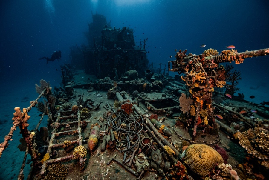
SS Thistlegorm — illustrative image

SS Thistlegorm

Wreck 16–32 m Intermediate Sharm El Sheikh & Ras Mohammed, Egypt
Ilustração gerada por IA
Bem documentado
Profundidade
16–32 m / 52–105 ft
Profundidade típica
26 m / 85 ft
Visibilidade
12–25 m / 39–82 ft
Água
21–29 °C / 70–84 °F
Corrente
Moderate
Acesso
Boat
Melhores meses
Apr, May, Jun, Sep, Oct, Nov
Certificação recomendada
Advanced Open Water
Mergulho típico
~45 min

A profundidade indica a faixa desde o topo do ponto até o seu máximo habitual; a "certificação recomendada" é o nível das agências convencionais que os operadores costumam exigir, não uma exigência legal. Correntes e visibilidade mudam diariamente — trate tudo aqui como referências de planejamento.

A British armed freighter bombed at anchor on 6 October 1941, the Thistlegorm sank with a war cargo bound for North Africa: Bedford trucks, BSA and Norton motorcycles, rifle crates, aircraft parts, and rubber boots still stacked in her holds, with two locomotives thrown onto the seabed beside her. Nine men died in the attack, and the blasted stern shows why - the bombs detonated ammunition in the aft holds. Jacques Cousteau's team dived her in the mid-1950s; she was then largely forgotten until the early 1990s and is now the busiest wreck in the Red Sea. Current can run hard along the hull, mornings bring queueing day boats, and the holds demand calm, controlled finning over eighty-year-old cargo.

O momento pelo qual você vem: Motorcycles still on truck beds in hold two; the anti-aircraft gun at the stern; locomotives on the sand; dense glassfish and batfish over the bridge.

Topografia: Sand seabed at about 30-32 meters with the hull upright and the stern section torn open

Corrente: Tidal current along the hull can be strong enough to demand the lines both ways.

Entrada: A long day trip from Sharm into the Strait of Gubal or a staple of northern liveaboard routes; descents and ascents run on fixed lines.

Este site é um naufrágio mapeado SS Thistlegorm — Armed British merchant navy freighter, afundado 1941. História completa do naufrágio e guia de mergulho →

Sabe antes de entrar na água

Perigos: Strong current on the lines, heavy boat traffic overhead, silt and sharp steel in the holds, and easy depth overruns at the stern.

Conservação: Take nothing. Decades of souvenir theft have already stripped much of the cargo's detail; artifact removal is illegal and mooring damage remains an ongoing concern.

Nitrox: Vale a pena aqui — os perfis situam-se na faixa em que o nitrox prolonga significativamente o tempo sem paragem (com a formação adequada para o usar).

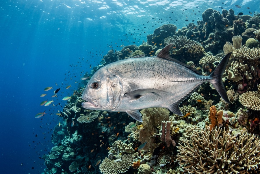
Quem vai encontrar
Para fotógrafos

Grande angular: ★★★★★ · Macro: ★★★☆☆ — classificação de 1–5 dos editores sobre o que este sítio oferece a cada estilo de fotografia

Austrália, Nova Zelândia e Ásia Oriental

Cairns & the Ribbon ReefsNingaloo ReefCoral Sea & Osprey ReefOkinawa & the Kerama IslandsPoor Knights IslandsTownsville & the YongalaGreen IslandIzu Peninsula

Caribe e Atlântico Ocidental

BonaireCozumelRiviera Maya & the CenotesBelize Barrier ReefGrand CaymanIsla Mujeres & CancúnRoatánTiger Beach & Grand Bahama

Europa, Atlântico & Mediterrâneo

Malta & GozoSilfra & IcelandThe AzoresCanary IslandsLarnaca & the ZenobiaScapa FlowArctic NorwayMadeira

Oceano Índico e África Oriental

North & South Malé AtollsAri AtollBaa Atoll & Hanifaru BayAliwal Shoal & UmkomaasMafia IslandMauritiusSeychellesSodwana Bay

Ilhas do Pacífico & Micronésia

PalauChuuk (Truk) LagoonFakaravaKona, HawaiʻiRangiroaTaveuni & Rainbow ReefBeqa Lagoon & Pacific HarbourEspiritu Santo

Mar Vermelho & Médio Oriente

Sharm El Sheikh & Ras MohammedBrothers, Daedalus & St John'sDahabHurghada & El GounaMarsa Alam & the Deep SouthAqabaDaymaniyat IslandsMusandam Peninsula

Sudeste Asiático e Triângulo de Coral

Bali & Nusa PenidaKomodoRaja AmpatSipadan & MabulAnilaoCoronKoh TaoLembeh Strait

As Américas e o Pacífico Oriental

Galápagos IslandsCocos IslandFlorida KeysSea of Cortez & Cabo PulmoSocorro & the RevillagigedosBritish ColumbiaCalifornia Channel IslandsCosta Rica Pacific Coast